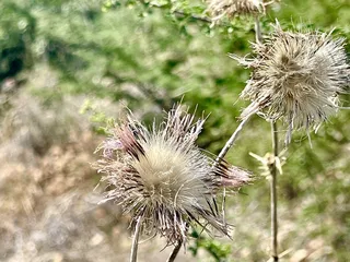
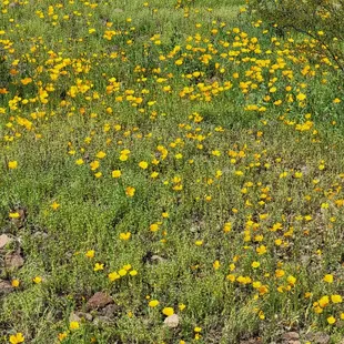
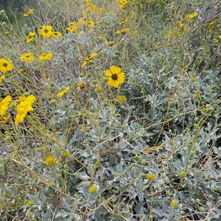
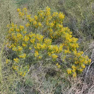
Poppies March 2023
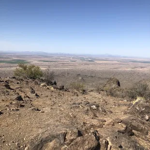
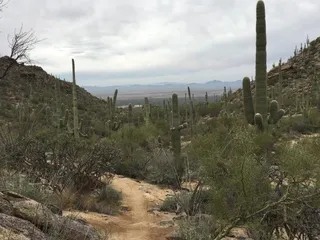
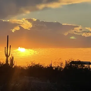
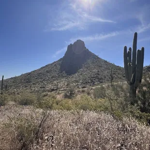
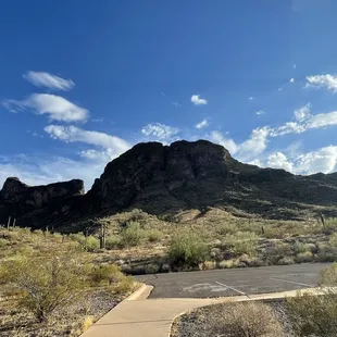
View from the summit
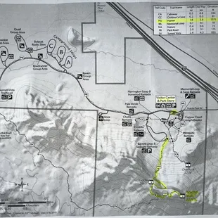
Official map with Hunter Trail hilighted (4/2024)
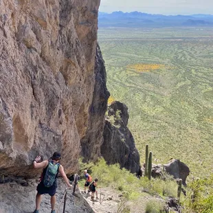
Descending from saddle on Hunter Trail
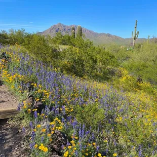
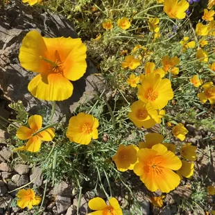
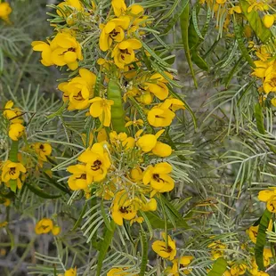
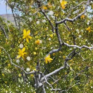
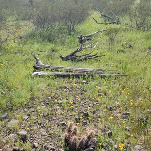
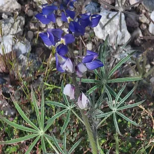
Wildflowers March 2023
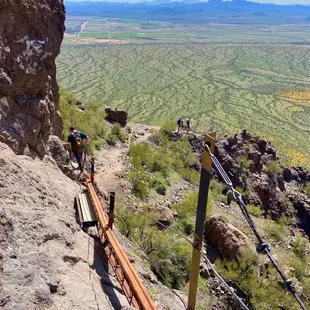
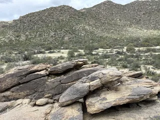
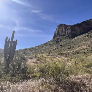
Descending from peak on Hunter Trail
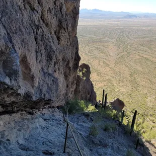
Start of the cables downward.
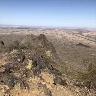
View from the summit
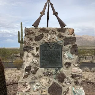
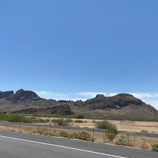
Park is location of Civil War battle

Maxine P.
Nov 21, 2024
Originally visited park to take a look at Peak that I was climbing. The State Park is the Location of the most Northern battle of Civil War. There is information about this historical event. The park has RV sites and camping close to hiking trails. There are a variety of hikes of different skill levels. All the hikes are exposed, with very little shade and can be warm even in March. Best to start early on all of them.The peak is a stunning landmark to photograph especially at sunrise or sunset.As I stated my reason for the visit was to hike the Hunter Trail to the summit.Rated Difficult, it's not for those afraid of heights and inexperienced hiker.The trail is a little more than 3 miles with elevation gain of more than 2,000 feet.There are number of cables to aide in the steeper areas, bring gloves.Some of the sections are very narrow with only cables for security. There is a climb that is 90 degrees with double cables for support as you scramble up. There are some high step-ups in areas.This is an out and back trail so what you go up, you go back down. As you wind your way up the peak you make it to the summit which provides expansive view of the desert below.The front side of peak, hike cables are pretty easy, once you reach the Saddle area is when it becomes more technical.It can look frightening, however it doesn't take a lot of upper body strength if you properly use your legs on the step ups. We are somewhat experienced hikers although in our 60s.Start at sunrise, fewer hikers and cooler. Bring plenty of water. We left one bottle at the Saddle for the way back to lighten load. Bring gloves for handling cables, wear good tread hiking boots, hat and sunscreen.Check park website for other trails. There is another trail that comes in from the backside, we chose not to add extra miles through desert to hike.It's one of those hikes you have a feeling of a challenge completed. Enjoy!
Read More
William N.
Sep 14, 2024
Beautiful location to do some camping. the hosts were very accommodating. Good day hiking as well. Good vibes y'all!
Read More
Cliff K.
Dec 6, 2024
Inside the park is serene and very quiet. You get a beautiful view of the mountain. There are plenty of areas to explore without hiking straight up the mountain. There's lots of trails in front of the mountain. I've enjoyed the ranger and volunteer led hikes relating to birds and Will return this winner. I also love to look at the wild flowers and wander through the trails looking for them. This park has historical significance.Relate it to the civil war.Some of the flowers i.have seen are bright yellow ones are call tufted poppies. The more orange ones are called California poppies. Some of the purple flowers with a white dot on them are called coulter lupine or desert lupine, or Mojave lupine, The pink ones that are standing up and kind of are brushy are a type of Indian paint brush called exerted Indian paintbrush... Other flowers are Purple Owls clover and owlclover purple Indian paintbrush. It has a well appointed RV and tent camping area.And i'm sure it's busy throughout the spring summer and fall.
Read More
Jeff B.
Jan 4, 2025
Well staffed and very clean park. Plenty to see and Amazon hiking trails for all levels. Be ready to non your own even though there are a lot of cars. Staff super friendly and helpful.
Read More
Miriam S.
Apr 23, 2024
This is a beautiful but very challenging hike. It's a little less than 3 miles but very steep. There are cables to assist you in the hardest spots of the trail. Make sure to bring plenty of water and grippy gloves. They do sell gloves at their shop in case you forget them.Their shop is very nice and has cold drinks and souvenirs at very reasonable prices.$7 dlls for the entrance to the park.
Read More
Mike S.
Apr 21, 2024
If you're in decent shape, plan on 2-1/2 to 3 hours for a 3.2 mile round trip to the top and back down. Hunter Trail is the most popular to reach the summit. There are numerous steel-cable assisted "climbs" ranging from 10 feet long to over 50 feet. Those cables are there because the slope is extremely steep or the width to the trail's edge is very narrow. The cables are very smooth but sweat and sun can render them hard to grip, so BRING leather gloves. The linear distance is not long but the vertical ascent is 1,400 feet but only 1.6 miles long which is why the hike is so steep. On this April weekend morning there were roughly 20-25 people that we passed, either going up/down, so a little busyMost folks conquer Hunter Trail in the morning. At that time at least 2/3 of your hike will be in the sun (Hunters Trail mostly faces due North) especially come summer when the earth's axis pins the sun straight up. TWO water bottles should be enough if you're not reckless about temps. And an apple/granola bar as quick carbs should suffice at the top.It's a hard climb to the top but the downhill - being just as steep - can be quite slippery with all of the shifting pebbles and sand-covered rocks. So wearing gloves on the entire descent proved prudent for us. Note: there are four single-file cable passes in the upper half of the hike. You might have to wait up to 5 minutes for any group to finish passing through those sections before you can progress in the opposite direction. $7 vehicle entrance fee is reasonable and just $3 for a bicycle or pedestrian if not entering by car. Visitor center/gift shop on the drive out is worth a quick stop. Prices are quite reasonable there too for books, hats, t-shirts.
Read More
Belle V.
Oct 8, 2023
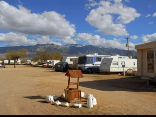
Inside the park is so different from what we see from the 10 freeway. The mountains surrounding the park looked amazing. There are 3 loops of campsites to choose from. The rangers are actively doing their rounds day in and day out. You'll feel safe here. Although it's not a full hook up, there are restrooms near the campsites. This is a good place for mountain climbing, hiking and star gazing. We really enjoyed our stay here. The only issue here was the bees at the dump station! I wish they have more than one. You have to be really careful because there were a swarm of bees when it was our time to dump!! But all in all, it was an okay experience.
Read More
Gina L.
Mar 22, 2023
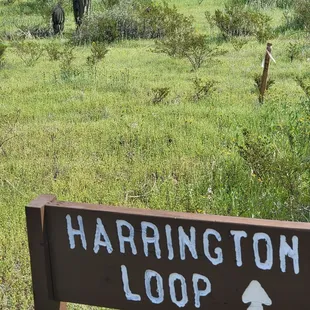
Came here March 12 when the wildflowers were blooming, and it was absolutely beautiful. Many trails present, including easy and moderate trails (Nature Trail, Calloway Trail, Sunset Vista Trail). I enjoyed the informational plaques along the Nature Trail. I also did Hunter Trail to Picacho Peak, which was challenging and technical at times, but very fun and rewarding! There are portions of cables on the east side, but it's after you reach the saddle and start descending the west side when the cables are more present and really helpful. Check out AllTrails for more detailed trail info. During wildflower season, expect a wait to enter the park @ the pay station. I arrived at the highway exit (Exit 219) around 11:30am on a Sunday, and the car line was about .7 miles from the entrance. It's slow, but inches along. I did see people park along the road and even at the gas stations, and walk into the park. Even when I left around 4pm, there was a short line to get in. Park closes at sunset, so plan accordingly.
Read More
Lydia D.
Oct 8, 2023
Picacho Peak is a staple along the highway near Tucson. And the hike to the summit is tough and interesting! You know the cliche about walking to school uphill both ways? That's the hike to the summit. You go up desert paths, down rocks, up rocks, up more paths - there are chains and makeshift bridges, some climbing involved - this is a full body endeavor. Beautiful views though! And everyone we met along the way was very nice. If you plan to hike, I recommend visiting in the cooler months!
Read More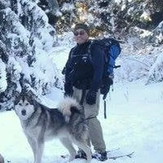
Don K.
Feb 20, 2022
Climbing the distinctive Picacho Peak was on my list of things to do in the area, so here I am. It's a state park, requiring state fees. $7 per carload. Note that there are two separate parking areas near the trailhead. I parked along the road with so many other folks.Started later in the day than I'd like, but it was still sort of cool temps. Not that it mattered much because I started sweating pretty soon after I started. The path to the saddle was pretty much straight up. The views on both sides of the saddle were impressive. Then the cables came into play as the trail went down then up along the rock face. Lots of fun scrambling up and down but remember to go at your own pace. Sometimes the cables are more of a hindrance, but I understood why they are there. Once at the top there were a lot of places to sit and enjoy the 360 views. On the way down the cables actually came in handy. It was a perfect day for the climb and lots of other folks felt the same. Would highly recommend!
Read More