Every photo has a story. Don't make this the greatest one ever told.
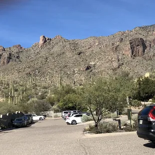
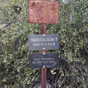
Parking lot
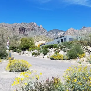
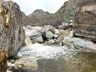
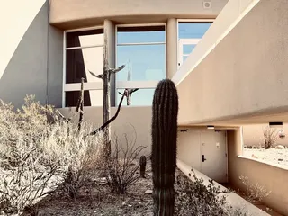
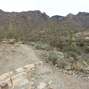
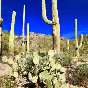
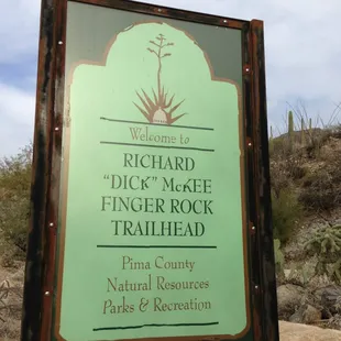
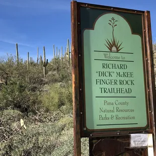
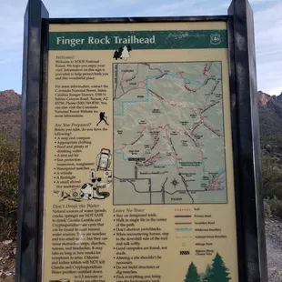
Photo from trailhead
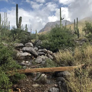
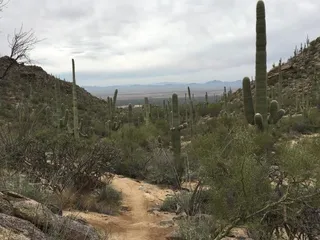
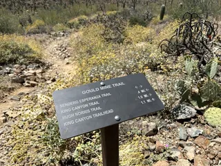
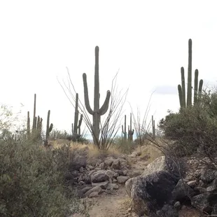
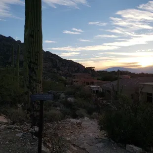
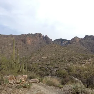
Start of the trail
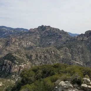
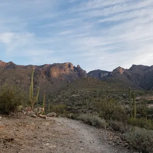
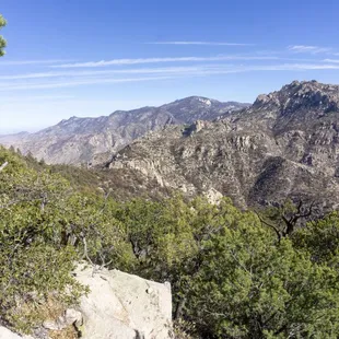
Photo from Mt. Kimball
Crazy steep second half
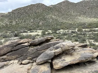
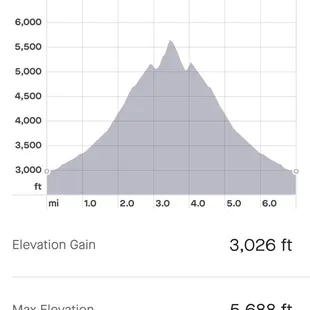
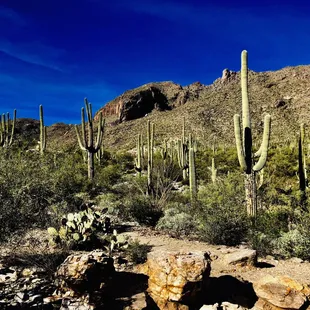
The mountain
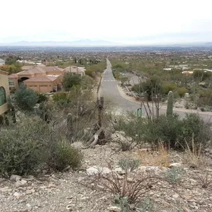
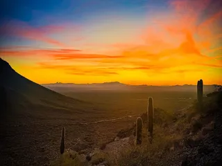
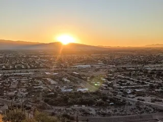
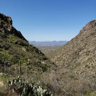
The view from Finger Rock trail to the city of Tucson!
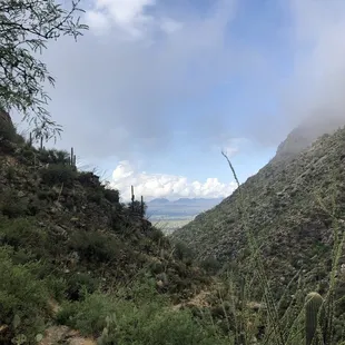
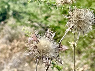
Beautiful views


Mike S.
Apr 19, 2024
Took an experienced road runner for a steep trail run at Finger Rock last wknd and she held her own! Spring blooms were inspirational and temps were perfect. Parking in the lot for the trailhead is free but limited to about 15 cars with 2-3 of those reserved for handicap. Remember sunscreen and have extra water in the car for when you return.
Read More
Amy Z.
Dec 30, 2020
This hike is no joke! I say this after having done the Grand Canyon rim-to-rim last week. The elevation isn't bad for the first 2 miles, then gets quite steep with loose rocks, sharp cacti, and sections of scree after the fire this summer. There're no real trail markers that far up, only stacks of rocks to let you know that, yes, as crazy as it looks, you're still on the trail.We meant to head to Mt. Kimball but there are no markers. So around mile 3 where the trail branches, we went left (instead of right) and ended up on a poorly marked path heading to the finger rocks.. then the trail and markers completely disappeared and we carved our own path for a bit on steep sections of scree before giving up. Great views and a good workout nevertheless.
Read More
Andrea W.
Dec 24, 2020
I came here on a Monday morning, arriving around 8:30AM and there were 4 cars in the parking lot including mine. The hike was steadily uphill the whole time, and some parts were easy to get lost but luckily there were cairns along the way. Since I went in the morning, there was also shade most of the way up which was great, and towards the top there's a lot of fire residue. I got up in about 3 hours, and the views are pretty great with all the mountains around! Coming down was a bit scary sometimes as the rocks and dirt were slippery, and the trail was pretty close to the edge a lot of the time so be careful! Great hike that has varied terrain and good views, would recommend! According to the map at the trailhead, this trail is ~10 miles.
Read More
Isabella J.
Nov 22, 2020
A must do in Tucson. This hike is hard. It's worth it. Take plenty of water, don't skimp on the sunscreen and start early so you get the morning shade. Do the short trail or the long one. They're both great. The desert fauna is always beautiful.
Read More
Cindy M.
Apr 1, 2019
Don't tell anyone but this trail is a 10! Strenuous workout up to Mt. Kimball as it is 5 miles of continuous up. Beautiful wildflowers, trees, vegetation, saguaros, rock formations. If you can only spend 10 minutes on this trail, do it. NO BATHROOM at trailhead and limited parking. So sad my phone was acting up on the trail, limiting picture taking. Shorter day, than nearby Window Rock trail, however, connecting trails will get you to Window Rock. Be familiar with trail as there are a few turnoffs.
Read More
Joshua D.
Sep 27, 2019
Great challenge! Loved the views and hiking through the clouds on a brisk morning. Couldn't have asked for a better time. Didn't go all the way up because I had to head back to Phoenix. Will definitely come back!
Read More
Roger T.
Mar 8, 2016
I just went on this hike recently and had a great experience. It it definitely considered a moderate to difficult hike especially near the last 25% of the hike. The hike starts off moderately easy at first but will begin to narrow in and be steep at certain areas. If you are afraid of heights there are some areas that will probably make you nervous but with the right foot placements and mobility, you'll do fine.To some people I may be exaggerating the warning but I understand some are not as afraid as others so I rather warn you in advance just to be safe. Other than that, make sure you pack lots of water. I had a 3L camelpack and used it all up for the entire trail. This was on a pretty warm day of low 90's and clear skies. The hike is extremely beautiful and challenging. But the view and outdoors is worth every breath and sweat. Definitely recommend!
Read More
John W.
Mar 6, 2016
Great hike to the top of Mt. Kimball. You need to be careful to switch trails at the ridge near the top from the Finger Rock to Pima Trail in order to get to the summit. There is a lot of technical areas on the trail so trail running is limited. The views are fantastic and the elevation of over 4000 ft is actually easier than some of the other canyons in the area with less elevation gain. I would be careful about bringing inexperienced hikers or children up in the trail because there are steep areas with lots of drop offs. All in all it is beautiful and there is a lot of shade due to the high walls of the canyon. Top notch hike.
Read More
Ray C.
Feb 5, 2013
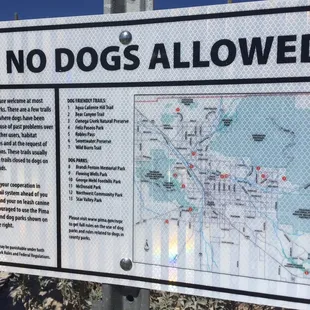
Hiking here for the first time. It was soo AMAZING! It is a great place for hiking! This place doesn't allow dogs and of course it may be too dangerous for them. This has a better view when you get on the top.
Read More
Doug T.
Oct 7, 2019
Relentlessly hard, hot hike with very rough trail terrain, overrated views, and little shade. I'm not sure why so many people give this trail such positive reviews. I thought it was the very least desirable hike I've ever done in the Tucson area, and I've been here 45 years. I've hiked many other similar trails in the Santa Catalinas, including Pima Canyon, Ventana Canyon, Esperero, Bear Canyon. I've also hiked Mica, the back way up Rincon Peak, Agua Caliente, Picacho, Chiricahua Peak, the Superstitions, Mt Wrightson, Wasson Peak, etc. Heck, I've hiked the entire John Muir Trail! Every one of them had a nice mix of steep and level, ups and downs. They all had significant stretches of well beaten down soil or sandy trails that made for reasonably easy walking, at least at times. But Finger Rock Trail to Mt Kimball is a really harsh, unpleasant trail. 90% of the time you're clammoring over boulders or dealing with loose, slippery rock. I can't count how many times you have to stop and step up or down at least a height of 2-3 feet to get up or down over a big rock in the trail. Over the whole distance, there are only about two short portions that were comfortable to hike on. Everything else (aside from the lowest entry portion) was relentlessly uphill, dry, and rocky, and this also made it tricky on the descent. I didn't see a drop of surface water and very little wildlife.I'm a good, experienced hiker and in good shape. I usually pass lots of other hikers on trails, and almost never get passed. I also have ridden 100+ miles in El Tour de Tucson multiple times, I play basketball, etc. Point is, I'm in good shape and experienced. Not a novice and not in bad hiking shape. It took me 4 hours up (with lots of short pauses to let my heart rate slow back down from the pounding, and to wipe the ample sweat from my head) and 3 hours back down, watching my steps so I didn't break an ankle or fall. Grabbing a few downed sticks as poles helped with balance on the descent, especially for all those slippery, big steps down over boulders. Look, I believe commenters when they say they have done it much faster, and I commend them. But I found this hike to be the least enjoyable I've ever done in Southern Arizona. Period. A 10-mile round trip hike would normally take me more like 4-5 hours, not 7. This trail sucks, in slope and trail condition. There are lots of shin daggers and an upper section with many thorn bushes.To make matters worse, the trail markings and signage are awful. I probably built 5 new cairns in various spots to help future hikers. At the junction with the Pima Canyon trail up on the ridge, there is zero indication of which trail to take to Mt Kimball, for anyone without a map. And no distances at all. Then at the top, there is no indication of a summit, and poor views. I could not find where the trail continues to Pima Canyon at all. There was one spot where you could look out over Oro Valley and another facing Mt. Lemmon, and Biosphere II in the distance. No view back toward Tucson or the Rincons from the top of Mt. Kimball. At least none that I saw. The only highlight was seeing thousands of ladybugs all over the logs and tree trunks at the peak. And I enjoyed having the trail 100% to myself all the way down to the parking lot.Much lower, there's a hairpin turn with a short, unmarked spur trail to an overlook with the best view of the hike. But it is not labeled with any signage either.It was an unusually hot day for early October, but I took tons of water and ate along the way. That's not why it was a crappy experience.I was not impressed by the views compared with many other area hikes. Yes, there were a few spots with great views, but that was limited.After reading all the positive reviews, I find myself questioning whether I've turned into a wimp in my old (49) age or if people are just trying to put on an aire of bravado by saying how much they love this hike. Maybe some didn't do the whole thing, or they did it in cooler weather, or are just in better hiking shape. I thought it was awful.
Read More