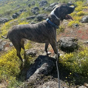
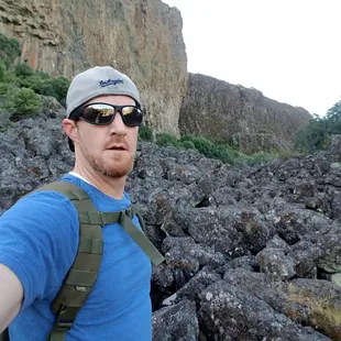
My dog
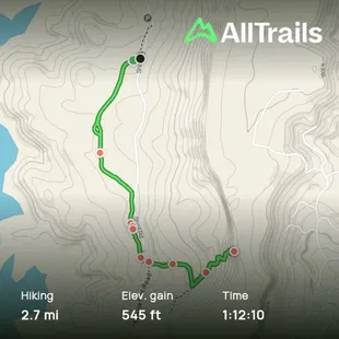
Map
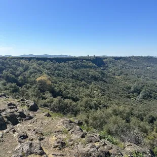
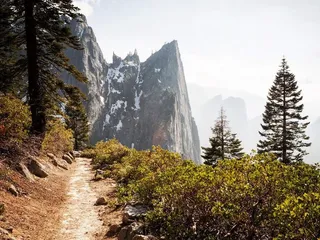
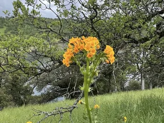
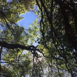
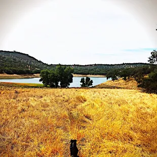
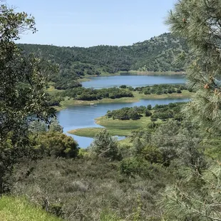
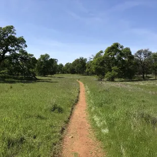
Scenery
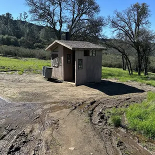
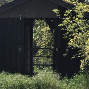
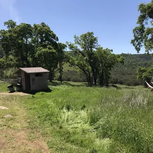
Bathroom
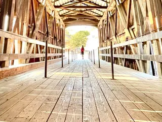
At the top of the
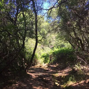
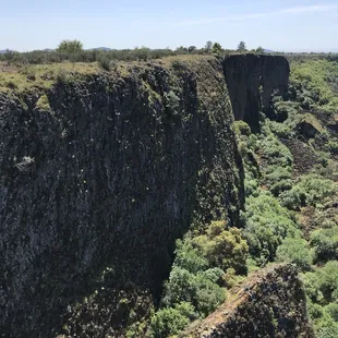
This path was a dead end...unless you wanna climb some rocks.
up up & away
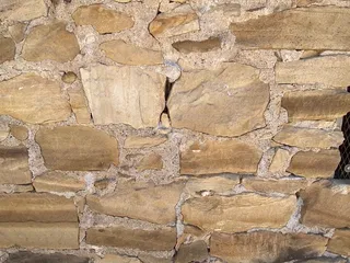
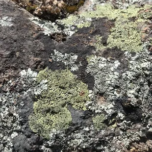
ladybanks
thar she blows
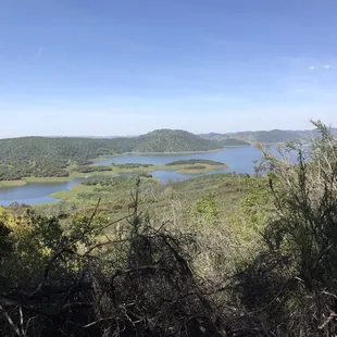
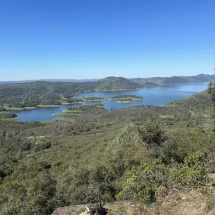
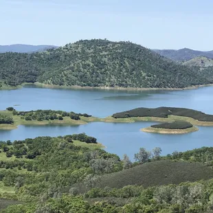
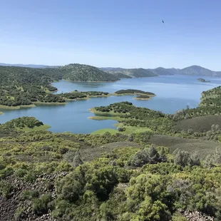
the view
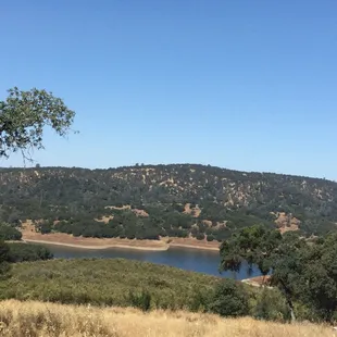
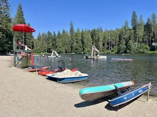
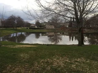
The lake by the restroom and parking.
Scot M.
Mar 16, 2024
This was a great hike. The weather cooperated and the trail was in pretty good shape. Not too many wet spots. I was able to take my dog on this trail which was nice. Gets steep and rocky at the top but worth the climb.
Read More
Doug C.
Jan 16, 2020
What a truly amazing hike this is with breath taking views along the trail and especially at the top. Located just outside of Jamestown and very easy to find, Tuolumne Table Mountain Trail is a must see 4 mile switchback trail that is challenging enough to satisfy the adult hiker while still being simple enough to be able to bring the entire family along with you. The trail starts out very slow and easy and builds in difficulty as you approach the top. Some areas were definitely more challenging than others. Bring plenty of water and take your time. The view at the top is worth it!The road to the trailhead is not well maintained so you may have to park another quarter mile or so away and walk in if you aren't in a 4 wheel drive vehicle.
Read More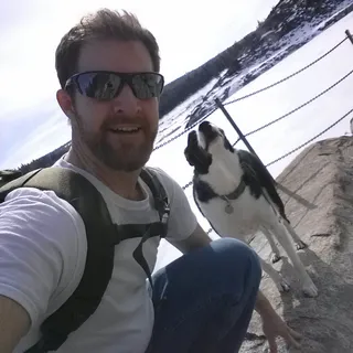
Jim W.
Apr 24, 2017
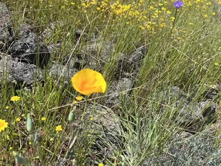
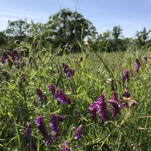
Checked this out for the first time on Sunday, April 23rd 2017I arrived at the trail-head around 9:30am. There were already a few cars in the very limited parking area. The Trail was very muddy and you will get your feet wet if you go after a rain. The Trail can be confusing, just remember to always go left. Bring shoes that can grip because it gets very steep as you approach the top of the mountain.The Trail is narrow at points and although dogs can make the journey up the steep terrain..if they are on a leash they may drag you down the mountain. The top of Table Mountain is huge. A lot of room to explore and take in the views. Lots of wildflowers and birds. Arrive before 9am to get a parking spot!
Read More
Erin P.
Sep 15, 2019
What a great hike, only a little bit of incline getting to the lake and back, but not too much so it's great for everyone . Very secluded. We only saw 2 other people all day. The dogs loved chasing the frogs into the lake, and there are stretches with beautiful yellow wild flowers everywhere. We will definitely be back!
Read More
Stacey W.
Apr 13, 2018
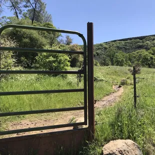
I tried this hike today around noon and got back to my car a little by 3:45. I think it was about a 5 mile hike and I spent over an hour at the top. I took the trail on Shell Rd. Basically the road dead ends where the trailhead and parking is. You'll know you made when you see a bunch of cars pulled off on the side. Parking is tight as others have mentioned. However by the time I left there were hardly any cars. You'll see a sign at the start saying table mountain trail right next to a gate. Once you go through there, just keep walking up the trail. There will be a fork in the road. Doesn't matter which direction you go in, they will meet back up shortly. Eventually you'll get to a restroom and you'll need to probably stop as there are no restrooms at the top. Then you'll cross a street and go through a gate like before. Just keep walking. The lake will be on your right. Near the top of the mountain there will be some boulders and the trail isn't exactly clear. At one point there was another fork, and I tried going right and saw a small cave. That direction didn't seem right and wasn't well worn on the ground so I turned around and went left. Another fork I came across, someone laid a large stick across the trail as if to tell hikers it wasn't the way. You'll start to see some switchbacks. You'll need to grab ahold of the rocks as you make your way up. It's not an easy hike. I saw a child aged 3 maybe having a fit and seemed tired. His mother carried their crying child down the boulders,which probably wasn't safe for anyone. You'll want to wear good shoes with traction as it gets a bit difficult towards the top. It was 5-10 min scrambling on rocks. The entire hike was one hour long each way. The top is super awesome and the hawks and birds fly around so close to you at that height. The flowers were pretty, and the view was gorgeous. I'd definitely go again.
Read More
Naty D.
Jun 7, 2015
The Grotto and Welcome wall gets crowded on weekends so come on a weekday if you can. Definitely worth the day off to explore all the routes.
Read More
Lee Anne M.
Apr 4, 2021
I read that this is a 4-mile roundtrip hike so I was prepared. When we reached the gate, the park ranger said we can also park near the 2nd gate but the dirt road will be rocky and uneven. We gave it a try, nervous the entire time because my CRV is not AWD. But we made it, and it cut our hiking trip in half. Trail was challenging enough. Million dollar views.
Read More
Jb Y.
Jun 16, 2018
No review since it was too hot. We turn around and left. There was no car at the main parking lot or start of trail. I did drive to the 2nd gate by the restroom. No car there too. Will try it again next year.
Read More
Lanny G.
Jan 1, 2018
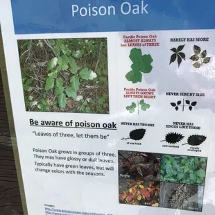
Nice hike. Great wildflowers during spring, but the limited parking at the gate by shell road fills up fast. Over parking there is going to mess it up for us in the future if you keep parking in front of resident's gates and yards. They are rightfully getting upset by this. You can go through the gate to further parking but the time of year and the abilities of your vehicle make ruin this option. You go in a high clearance vehicle or one you don't care about.Also we almost always see rattlesnakes and poison oak. No problem if you just keep an eye out for both. Never had a problem with either. Both are on the rocky, steep, shaded part of the hike. Beautiful views and flowers on the top. Great hike.
Read More
John R.
Nov 29, 2018
There is a new section of trail which you can descend off Table Mountain and make this a loop. If you take the trail, which is shown on the map up to the top of Table Mountain and hike southerly along the West rim of Table Mountain for approximately 1/2 mile you will come to a stone memorial monument. Continue along the rim for another 400 feet and you will come to a depression in the escarpment, follow this down (it is a little adventurous but most people should be able to do this) to the point where you will "T" into another trail (this is the climbers trail that goes to the Grotto climbing area, go there for another adventure). At the "T" turn left and follow this trail down to the Peoria Flat Road and back to your vehicle. An easier way to do this trail (it a bit less adventurous as you are going uphill in the adventurous section) is to get to the parking area with the toilet either by hiking or vehicle and follow Peoria Flat Road past the locked gate approximately 1/2 mile to a will defined trail that diagonals up and left (you will pass a couple of other indistinct trails on the left but you will know you are on the correct if you come to a steel power pole just right of the trail after going 300 feet on the trail) Continue up the trail and you will come to a rocky section where you will be hoping from rock to rock, continue past this section to a point where the trail descends into another rocky section. Before you descend find a trail on the right that does steep uphill, follow this trail to the rim and continue north along the rim to intersect with the trail going down after approximately 1/2 mile.
Read More