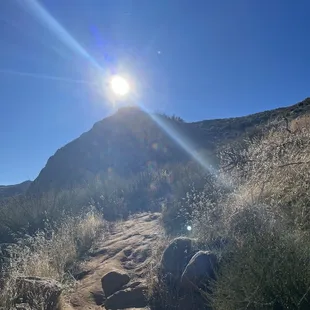
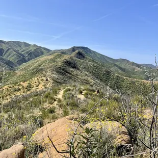
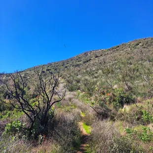
Oh yeah. Heading up
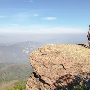
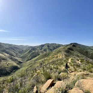
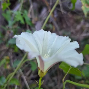
Cliff off Annie's Trail
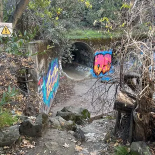
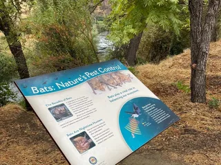
The tunnel.
Harry B.
Dec 13, 2023
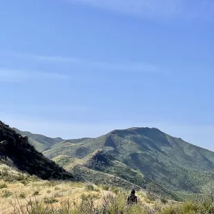
This is a great trail and running loop. Couple variations depending which way you run. Also connects with Alice chair and eagle rock. The views are great if lake berryessa and the trails can get a little technical. Make sure to watch your step. Easy to hurt yourself up on the top trail. But moderate technicals and effort 5 mile loop can usually do in 90-120 min depending how fast you want to go.
Read More
Vanessa C.
Apr 22, 2024
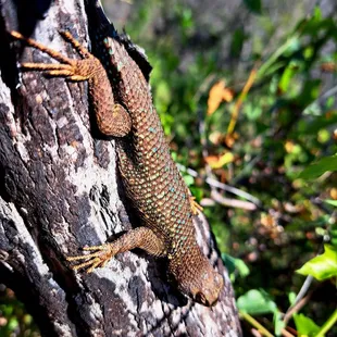
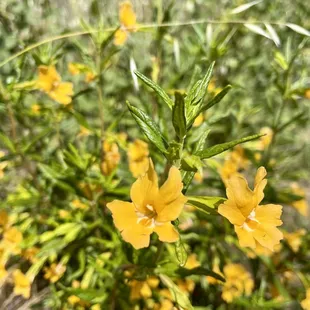
This is a great hiking trail. Many different ways to take the trail. Year round my fiancé and I hiking upward but during February-April we live to hike the lower end to see the salamanders. Theres plenty of parking, and the trails also really close to the glory whole at lake Berryessa, always cool to check out while you're there.
Read More
Christine V.
Mar 14, 2022
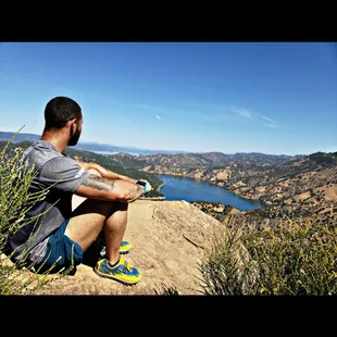
This was a great hike. People were friendly on the trails. Trail was clearly marked. We started with the steeper part first and about halfway through you can look out on berryessa and see the marina below. For next time I would bring more water and hiking poles because there were some spots that I could have benefitted from them.
Read More
Elise C.
Aug 6, 2022
This is a great hike bc it offers beginner to more advanced trails. I took my kids (7 and 9) and we made it pretty far in but there's lots more for us to see and hike on return trips. They are super excited to come back. It gets really hot in the summer so we went early and brought lots of water.
Read More
Ann L.
Apr 17, 2018
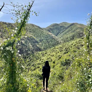
We went to Stebbins Cold Canyon Natural Reserve way up in Winters, CA on Sat 4/14/18. It's a 1.5hr drive from San Lorenzo, but on the way back 2hrs. There are 2 parking lots: Main parking lot which has 1 porta potty, the other parking lot is a little but up the road, they call Upper Parking Lot. Look at the graffiti art by the culverts, take your selfies, then take the Left culvert, both get to the creek, but if you are on the Right you still have to move to the Left because Trail starts on the Left side!The recommended route to me is: start at Blue Ridge Trail (Strenuous), Annie's Trail/Tuleyome Loop (strenuous), then down Homestead Trail (moderate) = 8miles. You can skip Annie's loop and just do Blue Ridge to Homestead for 5 mile loop.I didn't follow that and went up Homestead Trail and it wasn't too hard, there are lots of Stairs though. We did a short detour to see the abandoned homestead site - not much there, took a few pics and went back to the Homestead/Blue Ridge Trail. If you're short, the steps are way too high. I didn't like them at all. Then we did Tuleyome/Annie's Trail - did the loop. It's pretty tough. After the 1.25 mile marker you'll see Annie's Rock for nice stop to take pictures. The way to finish Annie's Trail loop is to go downhill, and it's all downhill for the longest time.Friend was too tired to continue going uphill on Blue Ridge Trail, so we returned on Homestead Trail.If you do both loops suppose to be 8 miles, I hope to come back in the Winter months Nov-Feb when it's dry, and no rain in the forecast.No Dogs allowed.
Read More
Josiah H.
Aug 14, 2017
If you're looking for a nice hike, or a good training spot (for my fellow terrain/Obstacle Course Racers). Then Stebbins Cold Canyon Loop Trail is the place for you.Located in Winters California (a little past woodland), Stebbins Cold Canyon Loop Trail is basically several different trails that at various points connect together. And that differ in level of difficulty and distance (Homestead Trail alone: 4 mi round trip, Blue Ridge Trail meets Homestead Trail to make a loop: 5 mi round trip, Annie's Trail: 2.75 mi). When combing two or more trails, your possible 5 mile round trip hike (or run) will turn into almost 7 or 8; so be mindful of that.I must have driven past the main area everyone talks about, but did see the resort, but kept driving. I ended up coming up to a smaller gravel parking area where I saw about 10 cars so I decided to pull in there to start my trail training session. Where I entered you could do either do the shorter Annie's trail or Homestead Trail, which would end up leading you to Blue Ridge trail. As I made my way on the beginning of my run I had to traverse through a rock bed full of huge rocks; bolders basically, but that's also because I chose to divert from the main trail going out. I ended up getting back on the trail now long after though and made my way to two huge tunnels which was kinda cool, my friend told me to expect them as she'd gone hiking here with some friends about two weeks earlier.When you see them it's like which one do you chose? Door #1 or door #2...I just chose #1, ran about 50 meters through the darkness and into the light at the end and continued on with my run. Slowly at first you make your way through the trail and gradually go up the hillside...at first. There was the occasional batch of stairs built into the trail and hillside, and then you come to a fork in the road where you can go left and continue on Annie's trail I believe. Or you can go right and make your way up Homestead trail and up the steeper climb of the mountainside. I chose Homestead trail and the more difficult climb.Before the major climb you weave in and out of narrow trails with multiple twists and turns, while having to duck under so some low level branches and even a large tree that had come down over the path. And after all of that THEN you begin the steep climb of endless steps....and I mean endless. I am very familiar with various hiking/outdoor terrains for my terrain training, and running various terrain races throughout the state in several cities to include Sacramento, Monterey, Temecula, Patterson, Pala, Plesanton, and Tahoe. And at various distance to include almost 15miles. And this little course with the steep stair climb, was a good cardio and endurance tester.My advice would be definitely bring plenty of water even though it's not a really long group of trails. More so because of the possible depending on the time of year, and time of day. And because the course does become a little more intense depending on what trail(s) you choose. I ended up bring my 70oz. Camelback with me, and added electrolyte tablets to it to replace the salt I'd losing from sweating while running. Also bring some energy/protein bars to regain calories to maintain your energy levels. Also bring sunscreen as many have mentioned there is very little shade on these trails, and you want to avoid sunburn and possible heat exhaustion or worse. People get heat stroke out here all the time according to the signs and have to be rescued.OVERALL: Great group of trails, nice scenery at time. Very sunny and out in the open so sweat sunscreen, and bring a sufficient amount of water for your activity level. And for the amount of time that you plan on being out on the trails!
Read More
Jerry W.
Jul 10, 2020
Stebbins Cold Canyon Loop Trail - was a nice work out, and very scenic, esp once you reached the top which over looked Lake Berryessa. I actually did the trail backwards, going up to the most scenic area first, which is about 1.5 miles up - pretty steep, but once up there, sit down, relax and enjoy. Started back up again....again going backwards....some pretty steep climbs, then finally about half way started declining.Over all the hiking was pretty strenuous, couple of the peaks, we're pretty rocky, and edgy.I started the hike around 8 am and finished around 10:30 am - temps were around 77 degrees and people were still heading up, thank god I started early.Enjoy the pictures !
Read More
Jessica S.
Sep 23, 2018
View at the end is beautiful but the hike in is long and not very scenic. If it's warm out, be sure to bring a bunch of water. From the parking lot, it's approx 2.5 miles to the view at the end. PARKING: arrive early because the parking is very limited and this hike is pretty popular.
Read More
Maria E.
Mar 5, 2018
Awesome hike. Fun, pretty challenging, and super rewarding. PARKING: There is a lot and if that's full, another lot up the road. BATHROOM: Port-a-potty located at the first lot.TRAILS: Clearly marked.AESTHETIC VALUE: Sky high. The views of Lake Berryessa are stunning. As others have mentioned, the trails start off via drainage pipe. That's a pretty cool spot for photos. DOGS: Only allowed on some trails. WATER: Stock up, especially in the summer. You're exposed for a while on the peak. SUNSCREEN: See previous entry. SHOES: Make sure you've got hiking shoes with good grip.We did the Blue Ridge Trail to the peak and then took the Homestead Trail down. About 5 miles. It was a bit of a tough climb at some spots but fun as hell. You can take the Blue Ridge Trail up and back down or do the same with the Homestead Trail. I recommend the loop though for the best experience with the most changes of scenery.
Read More
Kaneesia Kamil C.
Sep 14, 2017
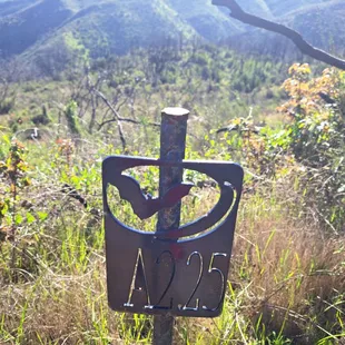
Be prepared to lose signal on your way here. We lost our friends because their GPS led them to another area, and we couldn't contact them! If you plan on going with a group of people, trail behind each other!! Long story short, we found them by using a phone booth nearby, and luckily they turned back to where there was still signal.Parking lot for this is really easy to miss. If you drive a bit more, there is another parking lot next to the road. You can also park there. LOVE how there were arrows to guide you along the way in the beginning. It can be a bit confusing without a clear pathway, so it is helpful to have a guide. This is a REAAALL hike! 10 minutes in, it gets very steep, very rocky and lizards were all over the place! We were already tired, but we did not want to give up. The weather was nice anyway-- sunny, but nice breeze of wind. It's surprising to actually hear the gust of wind, it sounds like a running river!We climbed for about an hour and a half. It was sooo worth it!!! The view was beautiful. It was nice going up as you see the mountains and trees, but seeing a body of water after all the hike is phenomenal. It took us about 30 mins to get down. There are some shortcuts you can take, but be very careful because they are really steep. It cuts down a lot on the time though.Overall: Would go again. One of the best hikes I have ever experienced!TIP: Take a picture of the map they have in the beginning so you have something to go back to halfway up. They stop putting the arrows at one point!
Read More