Reserve Chardonnay

Great family winery in Glen Ellen
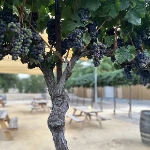
Wine vine
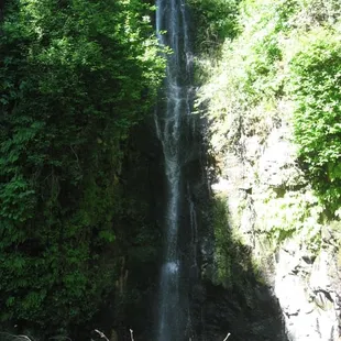
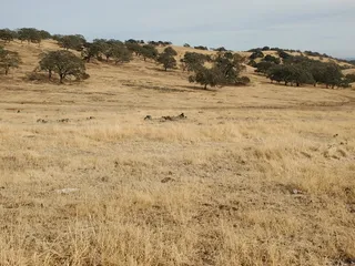
Green Valley Falls hike on 5/17/08

Jeremy W.
Sep 14, 2024
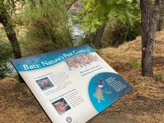
Join us on our journey to Green Valley Falls. Being the City of Vallejo's water supply, the creek and two waterfalls are closed to the public. If you want to check it out, you can sign up online for a guided tour, which only happens one or two times a year. We didn't feel like waiting, so we found our own way in...https://youtu.be/WFKupoHZrs0
Read More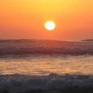
Todd F.
May 20, 2024
Nice camp. Camp Hostess is awesome. Unfortunately the state Park rangers r lazy and well, just lazy. Unbelievably loud music? They drive right by the offenders. Adjacent camp blocking access to our ADA site? Ranger doesn't care but is super hostile about parking to unload our gear, because we couldn't access the site. Visited two weeks prior to our stay. Weeds in camp were knee high. When we returned they were waist high. ZERO camp maintenance. No cleaning prior. No taking the dirt for trash. The only ranger action I witnessed was rangers standing around laughing it up.Also. The phone to the stations has been "full on fMessages" for at least 3 weeks.
Read More
Camille S.
Jun 30, 2023
I was able to visit Green Valley Falls in Descanso this past week. The Falls are still running strong, and beautiful. But there are currently no signs or warnings to watch out for poison ivy in the semi-shaded areas along the river, and excessive mosquitos and flies. Bring bug spray and stay away from bushes with 3 leaves. I learned after the fact. Poison ivy is no fun!
Read More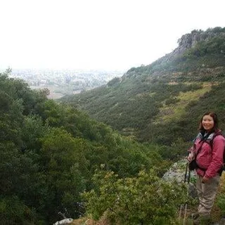
Ann L.
May 17, 2008
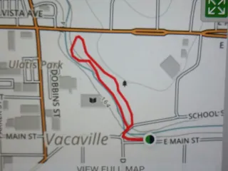
Green Vally Falls hike is on City of Vallejo watershed land and the only ways to see it is by signing up on a guided hike w/ the Bay Area Ridge Trail Council or with Solano County Sierra Club.It cost money to do this hike. With the Bay Area Ridge Trail Council it's $15 for non-members/$10 members. I think Solano Co. Sierra Club charge only $10 but not sure.It's a year-round waterfall, but the BARTC only offer it 3 times a yr. This yr it is: 5/17/08 (over), but there's still June 14 & Aug 9, 2008. You have to sign up online, put your credit card number, and wait. They said they'll charge my credit card after the hike just in case the hike gets cancelled. If you need to cancel you have up to the day before the hike to do so.When we got to the main entrance it was locked, had to wait until someone at the Watershed let us in. There's one pit toilet at the parking lot. The hike started after we all gathered. It's only 2 miles Roundtrip with only a small bit of uphill.To hike to the lower falls was just ok. We walked along a trail that was over a long pipe. No water for the waterfall there, but then it was just part of a dam, so does that count?The hike to the upper falls is cool! It's really high and beautiful. Some climbing, but everyone in our group made it. One stream crossing that was passable, just bring walking sticks & boots. Great views of the waterfall (pic above). We spent a long time admiring it. Then we turned around and headed back.Recommended.Start time: 9am, finished by 11:15am. So plan to be done before 12 noon.Directions: Interstate Hwy 80 East, Exit Benecia 680/Green Valley Rd, Make a Rt, then Lt on Green Valley Rd (up & over the Fwy), stay on Green Valley Rd until u hit the Green Valley Treatment Plant gate (next to Heritage Oaks Ln).Website to sign up:http://www.ridgetrail.org/calendar/detail.cfm?ID=323
Read More
Liz W.
Mar 31, 2021
It is our understanding at the Bay Area Ridge Trail Council that the Green Valley Falls hike is closed due to damage from the 2017 fires in this area. We periodically check-in with the City of Vallejo and unfortunately have not heard a date of when it would be open to public hikes again.
Read More
Ginger R.
May 17, 2020
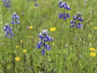
I've been on this hike and it's amazing . Beautiful falls in spring . Great family hike and refreshing when you get to the falls
Read More
Sue K.
Jun 27, 2019
I looked and looked , still haven't found the falls yet , found a few trails and made a few friends . It was worth looking for it
Read More
Flipper P.
Apr 30, 2015
What an awesome experience!! This special guided hike was two miles long with two lovely naturalist who where so informative of the history, plants and wildlife. Totally worth the 25$. I invited my coworker and her son Nick. I am a avid hiker but they are not and I was a blown away at how fantastic of experience it was for us all. The falls are just serene and fresh. A real treasure of Solano county. Nick was totally engaged and had a great time crossing streams, getting rained on from the ferns and counting the steps up to the dam. Love the organized Bay Area Ridge Trail hikes, never a disappointment.
Read More
Cheekie C.
Sep 4, 2022
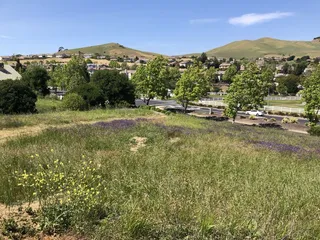
Couldnt find it must be a hidden road or something, led us to a field and didnt see any signs
Read More
heather m.
Jun 14, 2010
Just to be clear - this is a review for other novices to hiking. If you're experienced and know what you're doing, this review isn't for you.First, I was confused where this was located. If it's the City of Vallejo, why is it in Fairfield? I still don't know exactly but the city of Vallejo owns some property (and water) in Fairfield. So it's in Fairfield! Basically follow Green Valley Road (and don't follow Green Valley Lane, Circle, etc.) and it will dead end into the city of Vallejo property. If it hadn't been for the other Yelp review, I never would have found it.It's about 15 minutes off of I-80 heading north. The shopping center with the Safeway is last place to use the restroom and/or get a coffee. There is a porta-potty right by gate but that's it once you're up there.There were 11 of us. You must pre-register. Someone got turned away because there was a problem with the website registration. They hadn't registered early enough. You must register one week ahead of time (the city of Vallejo has a big list of rules - it's like the don't really want this hike to continue).Also, don't bring animals - not even birds that sit on your shoulder and poop on a little colorful diaper you wear around your neck. Don't ask.....The leader is an older lady (this is her last year) who was very nice and knowledgeable. However, she was also very soft spoken so a lot of her information was lost because no one could hear her. We started off on a road and moved to an unpaved service road. We left the road to follow a pipeline to the lower falls. That hike was horrible! The pipe is sometimes buried, sometimes not. Sometimes the soil around it is solid, sometimes not. There was a lot of walking (aka balancing) on the pipe that was very slick and I must have stumbled on the joints 20 times. This path was FULL of poison oak. After a good 25 minutes of walking, we get to the falls and there was NO water. NADA! But even if there had been water coming down, there was no nice place for everyone to sit and rest and enjoy it. We walked out the way we came in and joined back up with the dirt service road and walked up, up, up to the upper falls. There were 122 steps and some rocky area, more steps, a couple of bridges, but this path was much easier even though it was uphill. Once to the falls, they were lovely. And there was a lot of room to sit at the base of it and enjoy it. The walk back down was a little tougher - why is going down harder than going up on the ol' joints?So to sum it up:DO get there on time - gates get locked up around 9:10amDO wear long pants and a long sleeve shirtDO use sun screen and a hatDO wear hiking shoes (not Tevas or sandals, unless you want itchy toes)DO bring some waterDO bring a snack. We spent about 15 minutes at the upper falls and it was a good time to eat a Cliff bar.DO use a walking stick. Best $50 I ever spent. Or borrow one. Very useful!IF I HAD IT TO DO OVER AGAIN:I would not have hiked to the lower falls. The path was pretty treacherous (dangerous for someone out of shape with a bad back and twisty ankles like me) and the falls weren't that exciting. Right where the group left the road, there is a lovely little spot that the leader said is always full of butterflies (and it was that day). So I'd politely refuse to follow the group, promise to not move from the butterfly spot, and find a cool shady area to sit and watch the butterflies frolic. I wouldn't risk life and limb for a possible dried up waterfall that I can't imagine would be that great even if it was flowing full force. But that's just me.Extras:I just wore cotton pants & shirt. I looked at some of the higher tech clothing but didn't want to spend the money. It might have been nice but wasn't necessary.I didn't use bug spray (we went in June 2010). Bugs weren't horrible but there were a couple of times there were some of those annoying gnats in my face.The hike was taken through the Bay Area Ridge Trail http://www.ridgetrail.org The leader of this hike mentioned on in July 2010 but I couldn't find it on their website (which is kind of hard to use).
Read More