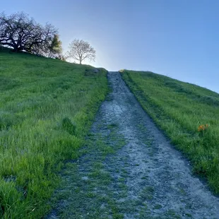
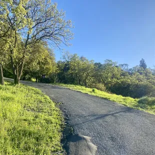
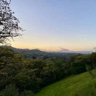
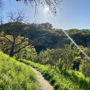
My view coming down
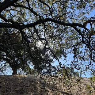
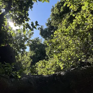
Peaceful
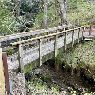
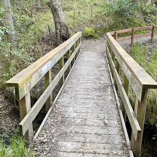
Cross bridge
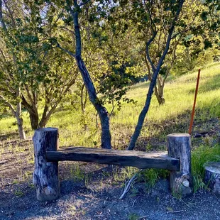
Take a rest ;)
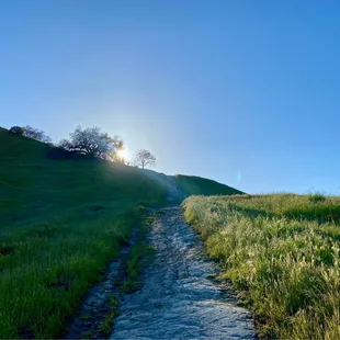
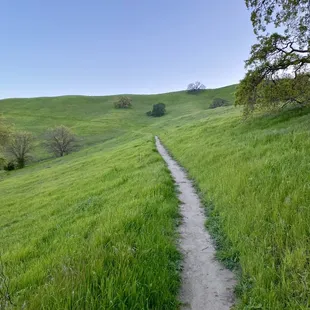
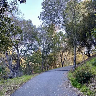
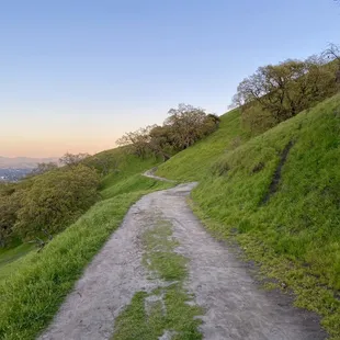
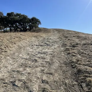
The climb
So pretty
Climbing this hill
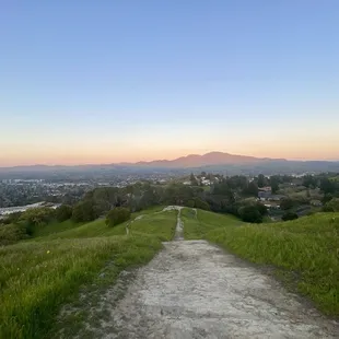
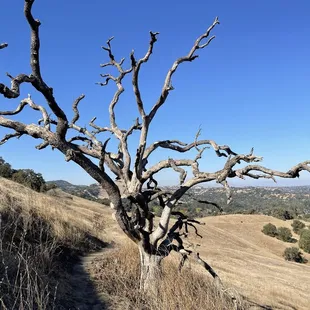
Briones to Mount Diablo
Briones to Mount Diablo Trail
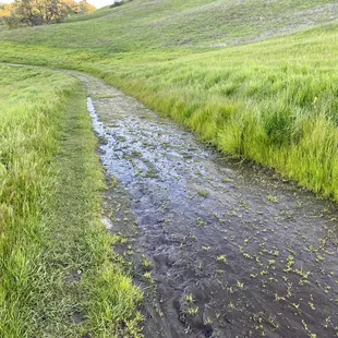
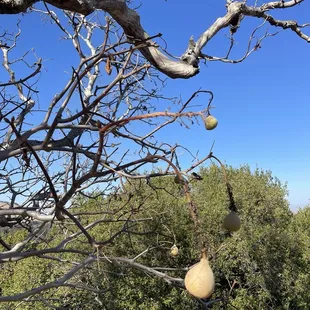
Very muddy on the Camino Verde Trail
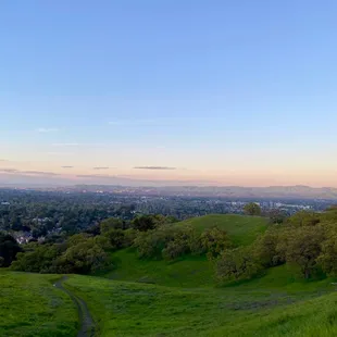
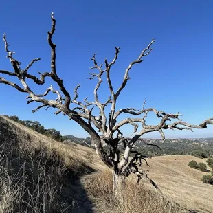
Great views here!
Yarrow Trail
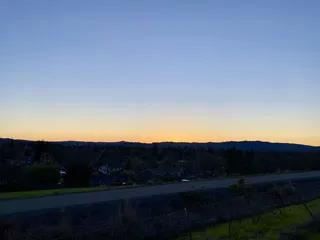
Chasing the sun

Steven K.
Feb 15, 2023
Are you looking for a short half-hour hike to spectacular views of Mount Diablo? Then Acalanes Ridge may be for you!I hiked the South Trail one sunny afternoon to see what I could see. Once I made it up the hill and emerged from the trees, I found myself on top of the ridge. At first, I could only see the mansions in the surrounding hills, but I was soon rewarded with beautiful views of the whole area as I continued on. From the ridge, I could see from Pleasant Hill all the way down to the Martinez refinery eight miles away on one side, and from Walnut Creek up to Mount Diablo on the other side.The biggest challenge with Acalanes Ridge is finding it (I used Google Maps to get there). The trailhead is tucked away in the hills above Walnut Creek, and there's very limited parking there. Put on sunscreen and bring water--the hills are a good workout and the trail is sunny once you leave the trees. Don't forget to stop and take in the views! If you're lucky, you might even sight a red-tailed hawk wheeling above.I enjoyed this hike and will have to try hiking it at sunrise next time.(Did you know? Before the days of radar navigation, airmail arrows used to be lit as beacons to guide pilots along the transcontinental airmail routes at night. The arrows on Acalanes Ridge are among the last remaining airmail arrows in the Bay Area.)
Read More
Shayla B.
May 26, 2018
Walnut Creek is filled with so many little hiking gems, and Acalanes Ridge is the perfect example of one. I discovered this ridge while walking along the Briones to Mount Diablo trail and continued my journey up. Curiosity ALWAYS kills this cat. So when I got to a gate that read "Walnut Creek Open Space", I knew that something wonderful was up ahead. I opened the gate and headed up to the top. If you are entering Acalanes Ridge through this entrance, make sure that you bring plenty of water and lather up on that sunscreen, especially when it's warm out. There really isn't much shade and it's super dry in the summer. The first couple of inclines are rough! I was breathing so hard and boiling in the sweltering heat. You have to reach the first ridge (informally known as "Beacon Ridge" according the google maps) before you make it to Acalanes Ridge. After tackling two steep inclines, you'll come to a 4-way intersection. Turn left up the hill to continue along the Briones to Mount Diablo trail to Acalanes Ridge. The trail will get narrow and you'll being inclining at a moderate pace. Soon, you'll reach a small trail map that will show you where the top of the ridge is located. A fun fact about this Trail: it was one of John Muir's discovery trails and is now apart of the John Muir Land Trust. You'll continue to the top via the super narrow the Gary Rogue trail. The views are gorgeous but this trail is so narrow that I was literally just watching my feet on the ground to make sure that I didn't slip it trip over anything. There's another trail that is much, much steeper but it will get you the top in about half the time. Unfortunately, it was under restoration and closed to public access. I would not recommend exploring this trail because it looked pretty dangerous.Once you reach the top, you'll be rewarded with the most wonderful views of Walnut Creek and its' rolling hills. The hills may be mostly dry brush if you are going in the summer and fall, but it won't take away from the glorious views of the city. I'm happy to have discovered this Walnut Creek gem, and I'm excited to enter the ridge from a different entrance next time.
Read More
Nick S.
Feb 8, 2020
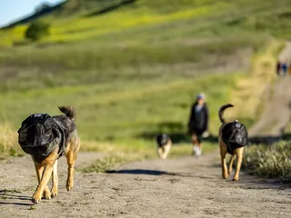
This is my new go to walking spot! Overall it's a fairly mild hike, nothing too strenuous. My dog is 16 so he can't handle too difficult of a hike and this one is perfect for him. He can make it down the Sousa trail to the water plant and back. Several trails and cool views to see. It's totally a little hidden gem. I live in the Larkey neighborhood and was looking for somewhere new to take my dog and it's easy access for me, others might find it hard because there's not a lot of parking and it's almost all residential. I still highly recommend this place!! Pros: Not too difficult. Quiet, not tons of foot traffic. Scenic. 90% shaded. Geocaching. Cons: Parking. Narrow paths make it hard to pass other dog walkers whenever you do happen upon them. Honestly my favorite part is the shade! There's more shade than not on the paths and in some areas it was dense enough shade to keep you fairly cool in 100° heat!
Read More
Ron L.
Sep 30, 2018
There are two parts to Acalanes Ridge, and neither of them are easy to get into. Which makes it all the more special.One is that tiny piece of land at the freeway intersection, where the flag flies. Drive deep into a middle-class-looking section of Lafayette, park at the end of the road, and huff and puff your way up the only trail. The result is a 300-degree view of Lamorinda, Tri-Valley, and Central County. A shadeless, sunny, slightly windy place to exercise yourself and your dog, and even a bench at the top to sit down and enjoy it all.The other is the open space on the east end of Pleasant Hill Road where it starts going uphill. The best trail access is on the other side, and this open space may be what most Yelpers are writing about. Many more trails to choose from, still little shade, still lots of views. There is also one clump of trees hidden away that would make a great family photo when the grass turns green.Acalanes Ridge is not overrun with people. So even though you won't have the whole place to yourself, you feel like you're getting your alone time in. Even though civilization is always in sight, you're far enough away that the traffic noise is low. I find myself having better prayer walks when I'm surrounded by trees, but Acalanes Ridge works well for me too.Acalanes Ridge, definitely the fire road less traveled.
Read More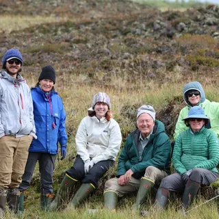
Eric B.
Jul 15, 2012
Walnut Creek continues to pleasantly surprise me with the variety of Open Space that it offers within its City Limits. Thanks to Mayor Bob's Walks and Gayle's CERT Volunteers, I now had to pleasure of hiking around Shell Ridge (starting at Howe Homestead and ending at Borges Ranch), Lime Ridge, Sugarloaf Ridge, and now Acalanes Ridge.My Acalanes Ridge Hike was part of Mayor Bob's 2nd Saturday Walks (the August one will be through Rossmoor) and started in Larkey Park with ~30 fellow travelers. It was a decent climb up and with a spectacular 360 Degree view at the Top. What I love about the Bay Area is the ability to be anywhere, hop in the car, take off on foot, and be in the middle of nowhere inside in around 10 minutes. This hike was no exception, although the Top might be a little shorter hike from the Lafayette side. There's also a small satellite Acalanes Ridge Open Space to the South that's next on my list. Then of course there's all those nearby and yet unexplored East Bay Regional Parks and Mt. Diablo State Park trails. Maybe a membership in the Orinda Hiking Club is in our future?
Read More
Amy S.
Feb 5, 2013
SPRING IS COMING EARLY THIS YEAR!At least that's what the Punxsutawney Phil said on Saturday. Yes, the little rodent has given all the non-lovers of winter hope for warm weather, coming soon.I celebrated Groundhog's Day 2013 by going on the "Big Rodent Day Hike" sponsored by the City. I heard about it through an activities guide that my parents and other WC residents receive from the Recreation Division. It's an annual group hike through the Acalanes Ridge Open Space. Our informative leader, Ranger Weidman, is a Penn. native, and even wore a Groundhog hat to keep with the spirit!He pointed out edible plants and even though it was suggested we take them home to wash them, I tried them all right there. He set up sandbags to give us an idea of the size of groundhogs and we found these as we hiked. I'm glad they were full of sand because protected groundhogs are HUGE! The hike was beautiful. I had no idea these paths were off of Larkey (and I lived on Larkey Lane when I was born!) Mom probably knew we would have more fun at Larkey Park! Our guide walked us through a gorge with a bridge over Putnam Creek. We carefully avoided the rampant poison oak but still managed to interact with plants such as the California Bay and the Golden Fern. We walked past EBMUD's Larkey Reservoir and filled our reuseable water bottles at the drinking fountain.The event invitation had mentioned delicious groundhog ribs would be served at the end of the hike. Fortunately for the fuzzies, we were given chocolate groundhogs (and they were delicious!) We all wrote haikus before parting ways, except for one lady who didn't understand the concept of syllable counting.In closing, my haiku:Groundhog nature hikeWalking with husband and friendsTasty rodent ribsFor more information on the hoggies: http://animals.nationalgeographic.com/animals/mammals/groundhog/
Read More
Sonja P.
Apr 2, 2015
I was hoping to see starry starry night at the top where the concrete arrows are, but I guess it was covered in graffiti. I saw remnants of it but nothing much. The hike is relaxing though, walking along the ridge. Didn't see any rattlers so that was a plus...just a slightly big lizard.
Read More
Rebecca H.
Oct 15, 2012
Went to the Bacon Avenue entrance, it was a big disappointment. It's an easy walk, hills aren't steep, but the whole time you are in between houses, looking over the freeway, walking past trash and dog poop and broken glass. As you walk you get closer to the freeway. We walked about 20 minutes in and then decided we weren't enjoying this location and left. I think we'll try a different area and see if it's better, as there are lots of trails and entry points in this recreation area, with south and north areas.
Read More
Amy D.
Aug 30, 2016
The best place to hike with your dog off leash! We hike there everyday. Nice views as well.
Read More
Jeremy S.
Jul 14, 2008
At first, it looked pretty lame, but as you get higher on the path and go through the cattle gate (don't forget to close it behind you!), there are some really great views. It is way too close to houses, but if you look in certain directions, you can at least create the illusion of being far away from the maddening crowd, albeit temporarily. And it's free. Watch out for the cow pies!
Read More