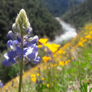
lupine and poppies
mosquito bills
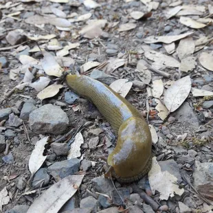
banana slug
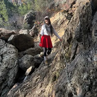
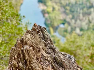
Stevens Trail
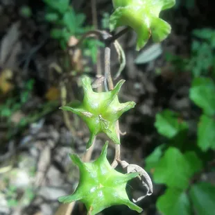
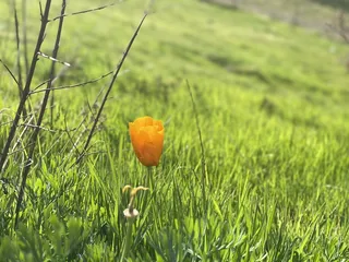
flower
wildflowers
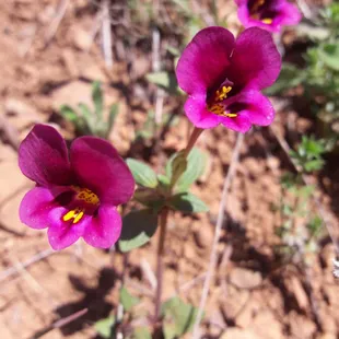
wildflowers
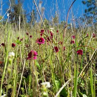
wildflowers
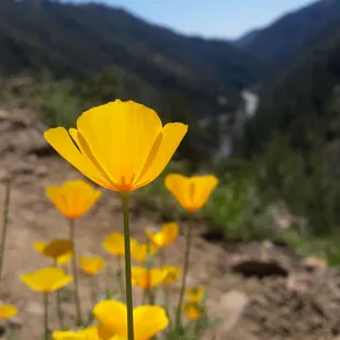
poppies and north fork american river
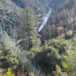
Stevens Trail
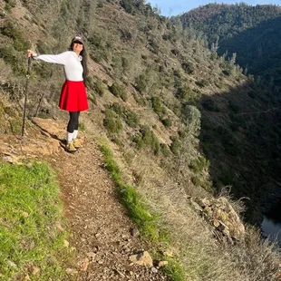
Stevens Trail
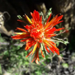
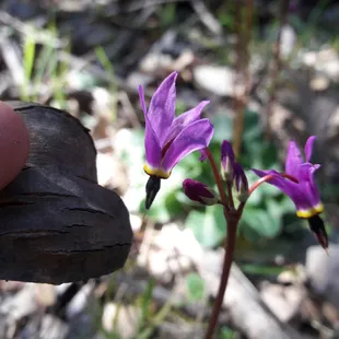
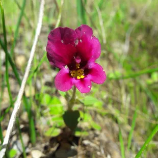
Indian paintbrush
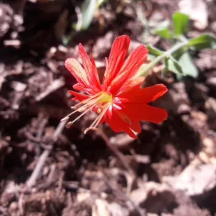
wildflower
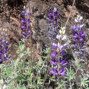
lupine

flower
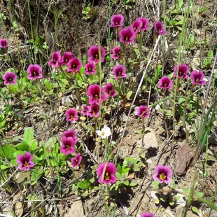
wildflowers

Ivory B.
Feb 10, 2025
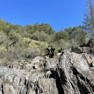
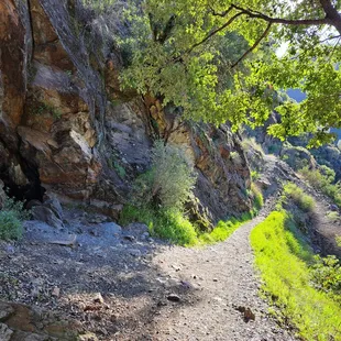
Steven's Trail is about 8 mile out-and-back trail near Colfax, California. The trail will be along the northwestern slope of the North Fork of the American River Canyon. This trail is well maintained and naturally beautiful but a bit challenging. It took me about 4 hours to complete.Parking is limited, so be patience, especially on the weekends. To get to Stevens Trail: Follow I-80 East towards the town of Colfax and exit at North Canyon Way. Travel along North Canyon Way for about a mile. Go past the Colfax cemetery to the Stevens Trailhead. Parking will be on your left.There's a cool cave! Exploring it and you may find yourself having a blast. Garbage in. Garbage out. Please keep the trail pristinely clean. Enjoy!
Read More
Jennifer S.
Apr 19, 2022
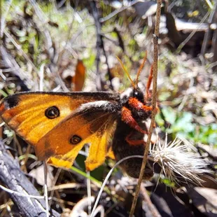
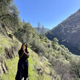
Back when I wanted to go for my first ever solo hike, I asked my friend Molly, who went hiking by herself all the time, if she knew of a good, well-populated trail to try.She said something to the effect of, "Steven's Trail is a little hard, but I think you can handle it."This trail has since become one of my favorites, and I've hiked it several dozen times now, sometimes alone, and sometimes with friends.Most recently, I came hiking here with someone who I was dating last summer/fall. I asked him if he was sure he could handle a moderately difficult 8 miles-- 4 miles down to the river, and 4 miles back up."You keep thinking I'm not going to be able to keep up with you," he said. We packed up some fig jam, honey, and almond butter sandwiches, some Lara bars, vegan jerky, a few cans of Truly, and some Mary Jane, and headed out to Colfax.If you are hiking this trail for the first time, I would recommend picking a cooler day, if possible. We came out in October, so it wasn't terribly hot. The downside was that none of the waterfalls were running. The nice thing was that the river flow was so low that we could practically wade across it.In Spring, in a good year, the river can be raging. People go white water rafting not far from here.Also in Spring, you can find all kinds of wildflowers on this trail. Some of the ones I've seen include monkey flower, irises, succulents, thistle, Indian paintbrush, innocence, Sierra Nevada checkerbloom, poppies, and lupine, just to name a few.The waterfall usually flows in early Spring, and in a good year, can flow as late as early fall. It looks like a slow flow from far away, but up close, the waterfall on the hiking trail can be such a challenge to cross that many people just turn around.When the waterfall has a stronger flow, I prefer crossing it on the bike trail, which takes you to the same place, at about the same distance.On four different solo trips last year, all during different months, I happened upon two ladybug blooms, and two butterfly blooms. I was sitting in the middle of the creek with thousands of tiny purple butterflies swarming all around me. Unreal.There is a decent amount of parking at the trail head, but it usually fills up by 9am or so on a busy spring weekend. People start to leave by 11, so either come early, or come late. There is a bathroom at the trailhead, although I'd recommend going to Taco Bell or the grocery store across the freeway instead, if you can. That way, you can recharge on snacks at the same time.Speaking of fuel, if you are planning on hiking the whole trail, I would recommend lugging along at least 2 liters of water per person, or even more on a hot day.Overall, this is a fantastic trail. This time of year, the waterfalls and creeks should all be flowing, and there should be plenty of wildflowers and butterflies to see.
Read More
Cheryl B.
May 29, 2023
Still some wildflowers to see at the end of May this year. Parking can be a challenge if you come later in the day. There is a bathroom at the trailhead so that is nice as most of us have a bit of a drive to get here. Be prepared. The way out is not too bad as its down hill with a few places to cross over water and one trick spot to cross where the water fall is but there is a chain against the rock to hold on to as you go thru that section. AS what goes up must come down do realize that the way out is almost all up hill and I believe its a 1200 foot elevation difference. Hiking polls are a good idea for those of us with short legs at there are some big steps due to rocks. Bring lots of water with you and bug spray is not a bad idea. Good luck.
Read More
Teresa B.
Jun 6, 2020
About a 50 minutes drive from sacramento. Very easy to get to. Get there early to get a parking spot. Note at the time I went (end of May), the bathroom was closed and taped off.There were some parts of the trail that were narrow and other requiring you to cross small streams. I would rate the hike intermediate to hard.There's plenty of shade and shelter but there's long stretches where you are exposed to direct sun. Weather forecast said 20 chance of precipitation so of course it poured. But the view was so worth it. Last time i went it snowed unexpectedly so be prepared for adventure!
Read More
Monika M.
Apr 30, 2023
Worth. The. Miles. Take lots of water. 60° and felt like 80+. Nonetheless, one of my fav trails ever.
Read More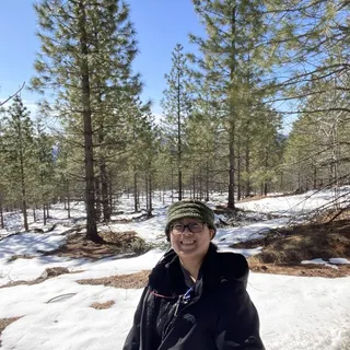
Pang M.
Jan 2, 2022
Lots of trees/branches fell down. Take gloves and a change of clothes in the car with you. The trees/bushes grew out making part of a path harder to get thru. All thru paths: trees/branches fell down and may continue to fall during your hike, and shrubs have grown out towards the path deeper in the trail (1 to 1.5 hours hike towards waterfall).January: Our hike took us a little beyond the waterfall. We turned back at 1:30 to make it back before sun down. We always made a left turn at each fork. It was a good and hard hike due to fallen trees/branches (obstacle courses for us). It is a moderate or difficult hike at times (not for children who are novice hikers).Note: at a fork after the tee pee, the right fork with a moderate-difficult incline goes towards the shooting range area (there is no sign to note that). Don't go too far out! I don't know where the shooting range boundaries starts and ends. A friend heard shooting nearby the last time they took this route.One portable restroom at the parking lot. No trash bins, so people tend to leave some trash at the lot and along the trail before the tee pee.I agree with some yelpers on this site about the litter, please pick up after yourselves. Treat all places as you'd like others to treat your space.
Read More
B H.
Apr 11, 2021
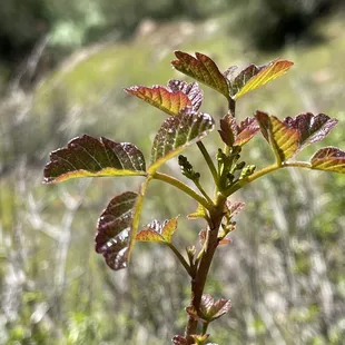
Its approximately 7 to 8 miles round trip.One restroom at the parking lot, ZERO trash bins. The land management really need to address that. Important: you need to know that this is a hike DOWN to the river, which means you have to hike back UP. That being said, the hard part is coming back. I couldn't believe how many people were NOT carrying water going down. Which brings me to point number 2.You NEED to bring water for the way BACK, unless, you're gonna drink river water. Will you die without it? No, but it's gonna be very uncomfortable without it. It's pretty steep especially the last mile. I'd say about 30-40 % of this hike is in the shade depending on the time you go. Get their early...The very small parking lot only has about 19 parking spots then you need to park on the main road. We arrived at 0750 on a Sunday. Only 5 other vehicles there. When we got back to the car around 1045, not only was the lot full but there were at least, 50 cars parked on the road. This is a narrow trail and extremely narrow at some points so, passing can be annoying.There is plenty of poison oak so be mindful of that. I wouldn't TOUCH ANYONE'S DOG either, specifically due to the poison oak issue. Thousands of poppies and other wildflowers. Pretty views especially of the river. Looks like a great summer spot with rock jumps and plenty of places to hang out by the river. I'd never come here in the summer I can see it being a cluster f*ck. Already kinda was its the first week of April. When in doubt, stay left... until you get to the river. Not sure of a true ending to this hike.
Read More
Jessamine J.
Feb 15, 2021
5/5 for the hike, location, and views! 3/5 for the parkingMy friends and I wanted to take an intermediate hike together. My friend had been here before and recommended this place. Hike: The hike is about 8 miles. The first half is all descent to the rivers and the way back up is all incline (so plan accordingly). I recommend a hiking stick. We went on this hike after it had rained the day before so it was a little muddy. The descent was slippery - so the hiking stick assisted a lot. Throughout the whole descent is beautiful trees, rivers, and mountains. The entire hike was beautiful. When you arrive at the rivers, you can swim in the rivers or dip your toes. There's plenty of rocks to sit on, but I recommend a seat cushion as there is moss on the rocks. Bring snacks and bring water! Our hike started around 10:30am and we ended around 2:15pm. We stayed down at the rivers for about 20 minutes for before ascending up to our car.Parking: My friends and I hiked on a weekday. There is a small parking lot that fits about 9 cars. We were able to find parking since there was no one there, but I assume on the weekends it gets pretty busy. By the time we finished our hike, there were about 10 cars parked outside the parking lot on the dirt road. I highly recommend coming on a weekday and coming early if you can. Overall, will go on this hike again! It was challenging, but not too advanced.
Read More
Daniel M.
Jul 21, 2024
This is not a moderate trail, it's hard. Bring lots of water, snacks, and extra cloth incase you get lost and need to spend the night. Trail branches off several times and you can easily end up getting lost, I noticed several people back tracking bc they took the wrong fork in the road. I took the wrong fork and ended up off trail, didn't have the energy to backtrack as i had run out of water and hiked into the abyss for so long. Sheriff helped drive me out, luckily there's cell service since it's close to the 80, he said people constantly get lost and have to be rescued from this trail. Also common to fall to your death there and be eaten by mountain lions if you're injured. Be prepared to hike out very tired. Besides that very beautiful and fun swimming spots.
Read More
Muoi H.
Apr 26, 2023
A must visit hike couples time of the year to see how the season transform the trail ! Easy to park and locate off the freeway!
Read More