Nice hike this morning
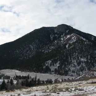
Blodgett Peak
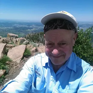
@ the top peak of Blodgett Peak!
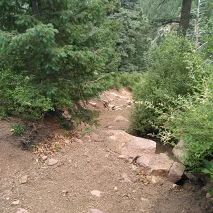
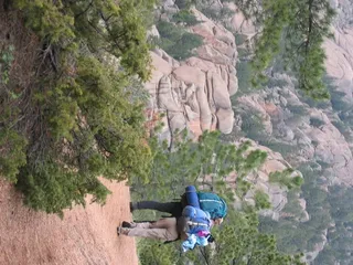
Steeper than it looks, gravely surface is like ball bearings. Easy to loose one's footing, conducive to butt sliding.
Note the Easterly false summit over my right shoulder. A more interesting route in my opinion. Not for dogs though.
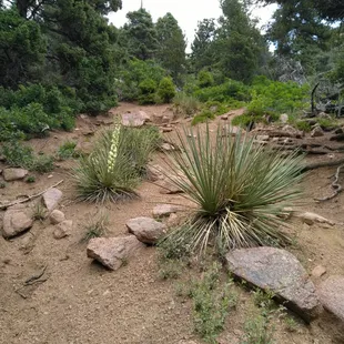
This is steeper than it looks. Gravel, rocks, catctus, and brush hazards make for tedious slow going.
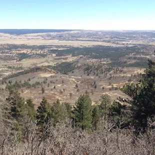
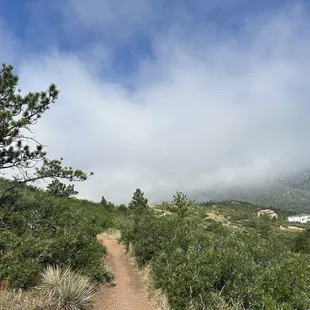
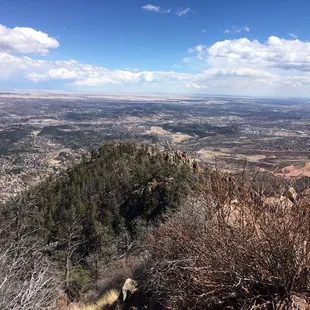
As far as the eye can see. Up to this point the trail is feasible and not too difficult.
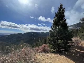
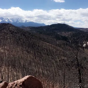
Awesome views, but cloudy today! :-(
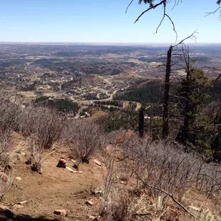
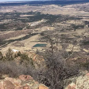
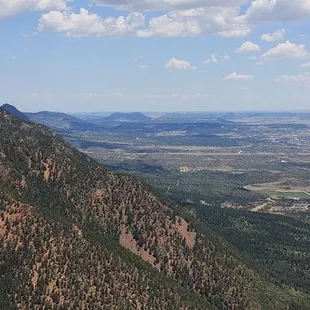
Gorgeous city views
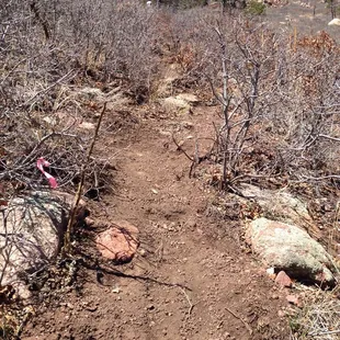
If you don't know where to hike, this is what expects you. Straight up through brush on gravel. BE CAREFUL!
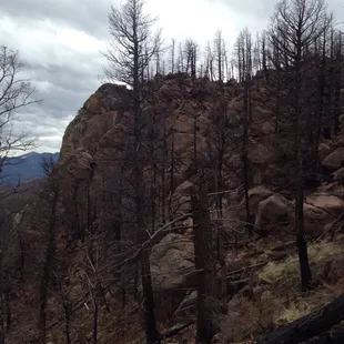
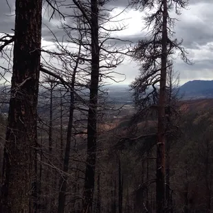
On the way up! Waldo Canyon fire is showing its ugly side at the top. There is no vegetation whatsoever left alive (save for a few grasses).

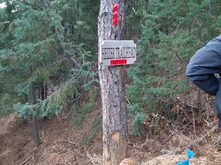
Henry's T.
Feb 22, 2023
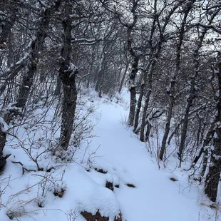
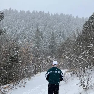
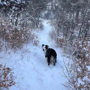
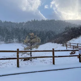
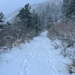
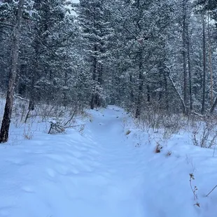
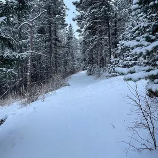
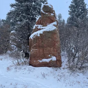
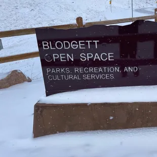
Trail Series, Part 15Ex*hil*a*ra*tion: uncontrolled feelings of euphoria or elation.I'm sure there's many ways to arrive at this destination. One of them is running, and running in the snow just takes things to a whole new level for me. With that in mind, imagine my exhilaration when a Review Team Member suggested we seize the opportunity to run in a snow storm today! Blodgett Open Space can be found on West Woodmen Road (just North of Orchard Valley Road) in Colorado Springs, Colorado. When we arrived it was snowing, 11 degrees, and it would have taken an legion to wipe the smile off my face! Rejoining our Review Team for this adventure was Jasper "The Mountain Dog", so our confidence for survival was high. On several portions of our adventure we enjoyed making "first tracks" in the snow and we basically felt like we had the mountain to ourselves. We reached a peak elevation of 7,500 feet and discovered that your phone will actually turn itself off as a defense mechanism when it gets too cold. While our experience was euphoric, we are sadden to report that not all of our Review Team Members returned safely to Base Camp with us (not true, and yes Jasper is fine. Check the pics and you'll understand. ).There are multiple trails to explore, so you can tailor your adventure to just how much glee you are prepared for.While not required for this journey, I found the use of snow micro spikes quite useful (they can be a fitted over your running shoes).And that's...Henry's Take.#snowrunning#blogettopenspace#coloradospringsTrail Series, Part 15Ex*hil*a*ra*tion: uncontrolled feelings of euphoria or elation.I'm sure there's many ways to arrive at this destination. One of them is running, and running in the snow just takes things to a whole new level for me. With that in mind, imagine my exhilaration when a Review Team Member suggested we seize the opportunity to run in a snow storm today! Blodgett Open Space can be found on West Woodmen Road (just North of Orchard Valley Road) in Colorado Springs, Colorado. When we arrived it was snowing, 11 degrees, and it would have taken an legion to wipe the smile off my face! Rejoining our Review Team for this adventure was Jasper "The Mountain Dog", so our confidence for survival was high. On several portions of our adventure we enjoyed making "first tracks" in the snow and we basically felt like we had the mountain to ourselves. We reached a peak elevation of 7,500 feet and discovered that your phone will actually turn itself off as a defense mechanism when it gets too cold. While our experience was euphoric, we are sadden to report that not all of our Review Team Members returned safely to Base Camp with us (not true, and yes Jasper is fine. Check the pics and you'll understand. ).There are multiple trails to explore, so you can tailor your adventure to just how much glee you are prepared for.While not required for this journey, I found the use of snow micro spikes quite useful (they can be a fitted over your running shoes).And that's...Henry's Take.#snowrunning#blogettopenspace#coloradosprings
Read More
Diego R.
Sep 11, 2022
It's rated class three on Alltrails. One scree section will probably require you to slide on your butt while descending. Their are better summit hikes in Colorado Springs with better views but if your a true hiker in COS you have to scratch Blodgett off your bucket list. Trailhead parking lot is small so be prepared to park on the side of the road as well.
Read More
Antanete F.
Apr 8, 2018
Great hike. Challenging and 3/4 of the way it's easy to become off trail as approaching the last portion of the hike. Rated Hard on AllTrails Give it a try, you'll see!
Read More
Manzano J.
Jun 27, 2016
Applying a review rating is problematic because so much depends on the hiker's conditioning and experience rather than the hike per se. Perhaps this is a trail runner's delight. Not being a trail runner, I can't say. The Blodgett Trailhead is easy to find and there is plenty of parking along Woodman Road once the trailhead parking is full, which is normal. From the trailhead, the trail starts on old asphalt and gravel road that bypasses a water tank. There are also community trails that traverse the front range in this section suited for casual chatty hiking with dogs and kids. I would go no higher if casual hiking is your interest. After leaving the wide broad road like sections of Blodgett Peak Trail, the climb upward becomes seriously strenuous through a maze of gravel, brush, and cactus lined social trails.As I discovered on the descent, I suggest hanging left as soon as possible and going up the left side of the intermittent stream until reaching the 'falls' that may or may not be running depending on the time of year. From here, there is no alternative but to cross the creek and begin traversing right through gravel chutes heading toward the saddle on the left side of the summit. This is very tedious hiking because of the ball bearing nature of the steep gravel surface that is often times mingled with stripped bare dirt. Rocks, scrub oak, and cactus adds to the hazards. It is easy to lose your footing, especially coming down. I opted to climb through the boulder field on the right side of the valley up higher. I did so to relieve the tedium of picking my way through the maze of steep gravel chutes and an inbred desire to explore the unknown. There were cairns through the predominately red rocks of the boulder field marking a route that lead to a chute that exited near the top of the Easterly false summit of Blodgett. This is a definite rock scrambling route but more interesting than slogging up gravel chutes, in my opinion. This route adds significant distance and time to the climb as the bushy ridge that leads to the actual Blodgett summit remains.I climbed Blodgett Peak once before, about 15 years ago. I doubt that I'll do it again.
Read More
Susi H.
May 17, 2015
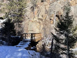
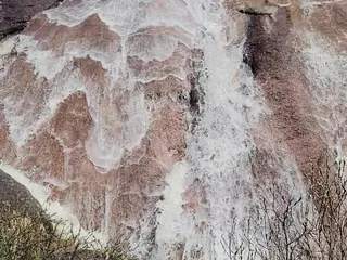
I absolutely loved doing this hike TODAY. The heavy rains have completely transformed the little creek and waterfalls. Instead of the rivulet of water we usually see, there is now a roaring creek and two full size respectful waterfalls that can be proud to be called such. It is very very sad once you get towards the top. It is a scene of desolation and despair. You can truly see the extent of the damage of Waldo Canyon fire on our mountains and hills. Atop Blodgett you get a 360 degree view of all the fire area as well as gorgeous views of the Air Force Academy, Black Forest, Colorado Springs and as far as your eye can see really. Oddly enough we get cell phone coverage all the way to the top. LOL.I disagree with the previous reviews stating that this is an easy hike or that it is good for children. THIS HIKE IS NOT FOR THE FAINT OF HEART. The terrain is treacherous at times and the trail is NOT marked. At times there is no trail at all, and you hike on your hands and knees. It is approximately a 4.7 miles climb from the parking area to the top of Blodgett...and the same if you want to get back to your car ;-) So expect this hike to take most of your day (unless you are a very experienced hiker). Only go with EXPERIENCED hikers who know how to get to the top or you will end up a casualty of the mountain as it happened only a month ago :-(((If one wants to only hike half way up the mountain, that is a fairly easy hike and one can bring kids. But NOT for the entire ascent to the peak. Too dangerous. Rock is loose and gravel is aplenty. Be careful out there!
Read More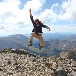
Alex M.
Feb 10, 2011
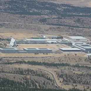
Looking for a decent hike in the Colorado Springs area aside from Pike's Peak or the Incline? Look no further...Blodgett Peak is closer to the Springs than both of those, and it's a relatively short hike (when compared to hiking Pikes Peak or any 14'er for the matter). The total altitude gain is about 2,000-2,500' and is about 4-5 miles round trip.The views from the top are actually quite nice and gives a much better perspective of the Springs, specifically all the neighborhoods that are literally at the base of the Front Range. Also offers a view looking North at the Academy and is close enough so that you can just make out people walking about there. The trail isn't extraordinarily well marked, but just aim up and you'll summit without a problem. There are areas of loose gravel/dirt which make getting down slightly more difficult but nothing hard.In short: A really nice hike close to home.Also, bonus fact: On the backside of the mountain, mid-way is an airplane that crashed in the 50's. The wreckage is still there if you feel like exploring
Read More
Jo L.
Sep 2, 2014
I've hiked Blodgett once to the summit on the south side, from Blodgett Open Space. Another time, I went up about 1/2 way on the north ridge, from the AFA to check out the remains of the plane crash from the 1940's. Either way you hike the peak, it's very steep and very loose. . . think scree. The scree is not so bad going up but (for me anyway) contending with the downward force of my body and scree at the same time makes for slow going and falling. And probably comedy relief for anyone who witnesses my descent.I like the hike from the South side best mainly because I didn't have to go onto the AFA to access the peak.From personal experience, wear long pants if hiking the south side. Once you start ascending the trail (there is really not a well defined trail at this point) to the peak, the trail is overgrown. My calves look like a cat mistook them for a scratching post because I wore shorts. Also, I wish I would have worn shoes with a higher top or wore a pair of summer weight gaiters. I wore trail runners and had to stop many times on the way down to get all the debris out of my shoes.While the Incline is out of commission for repair, this may be a good alternative for some. It's not as steep but it's longer. The views from the top are mainly of the city but you also get to catch some views to the west as well.
Read More
Norma P.
May 16, 2015
Absolutely amazing trails and great view from the top. The hike is steep on some patches but it's fairly easy that you can bring your kids or pets. The noise from the waterfall is relaxing as you go up. I would recommend if you want to go on a hike that's not too crowded and not too hard.
Read More