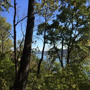
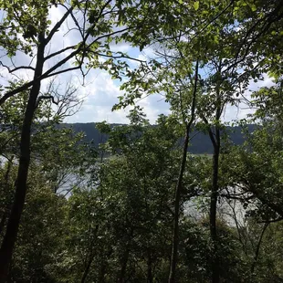
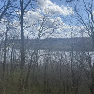
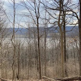
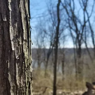
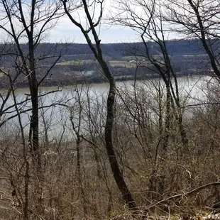
Overlook of the Ohio River
Overlook of the Ohio River
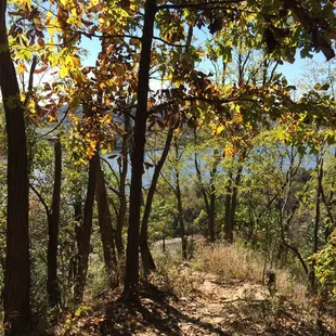
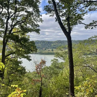
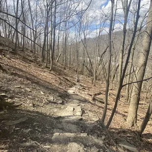
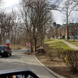
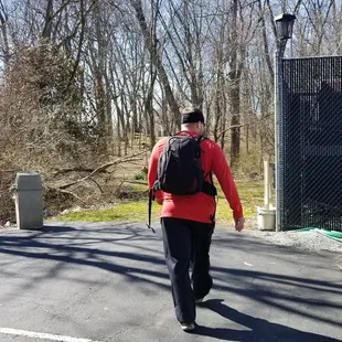
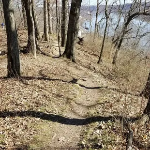
Check out these pics to get on Bender Trail
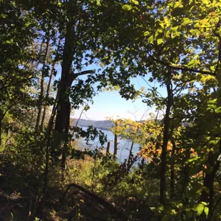
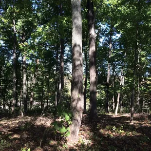
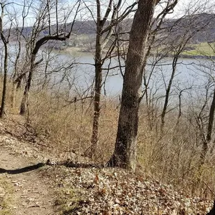
View of river
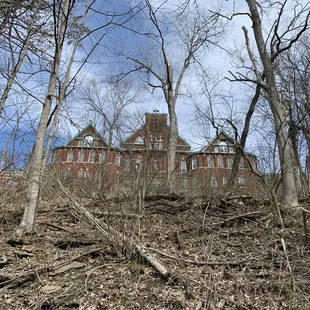
Overlook of the Ohio River


Lindsey K.
Oct 7, 2023
Great hike! The loop is just over two miles and provides a few great views of the river. Very wooded and beautiful nature. The loop provided about 500ft of elevation change so this is not too difficult for even the least experienced hikers.
Read More
Jeff M.
Apr 1, 2020
I've lived in Delhi all my life and visit many parks all over Cincinnati. For some reason I've never gone to Bender Mountain Preserve until this year. Why? I have no idea. It's close to home and it's trails offer an amazing workout.Bender Mountain Preserve has many trails some that go along the creek bed, with others that are much more difficult, climbing up to a 45 degree incline.Once up top there is an amazing view overlooking the Ohio River Valley and Kentucky.Bender Mountain Preserve is more hiking trails than a standard park. It's very remote and even during peak times you may only see a hand full of other hikers.Plus dog friendly!!
Read More
Tyler M.
Jan 11, 2021
This weekend, I wanted to hike somewhere new. I did some searching for the best trails in Cincy and the Bender Mountain Trail appeared as a top result. When I looked at the trail map, I was afraid there wasn't going to be enough trails to hike as long as I wanted to. However, after hiking the trails as well as the paved path, I had logged about five miles for the day (and would estimate that I hiked about 70%+ of the trails here).While it's not a mountain, it's definitely uphill. The views at the top were decent and the trails were well-maintained (thought can be slippery if it's muddy at all). We discovered a small cemetery at the top of the hill along the path, which I thought was pretty cool. If you're looking for a new trail to hike in Cincy, this is definitely worth the stop.
Read More
Vivian W.
Mar 12, 2020
Due to Coronavirus, we think the only thing safe to do is hiking in a park. So we picked this place to start our Coronavirus 1st hike. It's about 30 mins drive from home, and we came to the dead end of Delphi street, there is a sign says don't enter. I guess it's for car as it's fenced. But we saw people walk their dog inside, so we walk in, and it's a slope walk beside Ohio River, pretty nice, it should be a road in the old time, now because the road is mostly damaged, i guess that's the reason for the fence. The slope is pretty easy to walk down, but it does require some efforts to walk back! We saw few hiking trail beside the slope but didn't got in as we worried we might get lost. Maybe next time.
Read More
Caitlyn S.
Jan 22, 2017
Found this hiking spot doing some random searches on Google one day and knew I had to go when I saw there was an overlook of the Ohio River. There are two or tree entrances, but I took the one coming from by Mt. Saint Joseph. There only room for two or three cars to park in the spot, but it's in the shade unlike the other lot by the north entrance. When you take this entrance, you first have to walk down a long asphalt path before you get to the actual trails. And since there is an over look, it means you have some hills to climb. My friend and I who went are both in shape, but our legs were so sore by the end of our 1.5 long hike (we took a couple breaks and no way finished all the trails) that we didn't think we were going to make it back to the car. This hike is no joke. Be sure to wear long pants, because there are tall bushes and you can get itchy real fast. No matter the heat, you feel really cool as soon as you get into the real forest and go down the other side of the hill. (The hill is basically a line parallel to the river in the middle forest.) Be careful going down the hill towards the north side because the stones are slippery and I fell, even though it hadn't rained in days. The overlook is gorgeous, just make sure you keep going because it's at the very end. Can't wait to go back and see more of the place!
Read More
Libby K.
Oct 19, 2015
I explored this preserve based on some random links I found online and then stumbled across a Western Corridor Wildlife booth at Sayler Park Harvest Fest. They were handing out good maps and the coordinator told me of a good loop to try.I met with another hike lead (and her family) from Hike It Baby Cincinnati to explore it on a Sunday. The loop was only 1.2 miles, but had steep inclines toward the ridge overlooking the Ohio River. While there are steps going up to and down the ridge, you may find yourself winded if you aren't used to this many steps. I must say the views are completely worth the climb so do it even if it's only once.I would suggest long pants even in the summer because of some random sticker bushes heading down the ridge. My ankle got stuck on something, but no blood. No hat or shades necessary. Bring water and a camera if you get to the top.
Read More
Bora B.
Apr 27, 2017
This is a nice quiet place to go for a hike, as we only came across a handful of people in the hour or so that we were there. The woods are nicely grown with wildflowers abundantly growing. The biggest downside of this preserve is that the trails are not marked at all, and I had no idea if we would end up on a continuation of a trail or someone's backyard. There were a couple areas where trees had been downed and not cleared, which was frustrating when they were large and blocked most of the path. Overall, however, it's a nice place for a short hike on the west side of the city.
Read More
JP N.
Jun 17, 2022
Been hiking this trail for over 40 years.Prize the closest trail in the area to what you find at Red River Gorge- if you start at the Riverview nursing home and go all way down to Hillside ave.
Read More
Tara M.
Mar 18, 2018
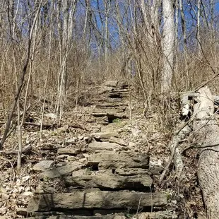
Don't follow your GPS! Go to Delhi and Bender rd. You can either park at the dead end on Delhi or go down bender and park by the retirement home. Check out the pictures so that you don't get lost like we did. Once you get to the dead end you'll walk down a long asphalt path on the right you'll come to a set of concrete and stone stairs. If you take those up you'll be coming into Bender trail from the side. Once you reach the top it will look like you're on the wrong road. You will be by the retirement home and walking towards a house in the woods. You are on the right track!!. Next you'll see a cemetery and after that you'll be walking towards Ridge Trail where the actual Bender Trail starts. Take a right at the first fork to complete the entire loop. I highly recommend this hiking trail-- there are lots of hills it is challenging at times and it's very scenic.
Read More
Jen C.
Aug 9, 2020
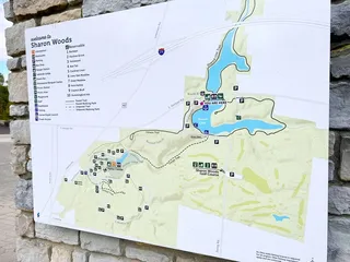
Several friends recommend this hike close to home so we decided to give it a shot. Because of COVID-19 the directions that other reviews offered as to parking didn't work for us (the stairs from Old Delhi Pike we're closed off). We ended up parking in the larger of the the 2 gravel "lots" on Bender Rd. (not far from River Rd.) You then have to walk across the creek bed to access the trail. I say all of this because there are no signs or markings. As we were finishing our few hours in the trails here we finally stumbled upon a map sign. There are some signs along the trails themselves, but without having the overall picture we were kind of guessing as we went. Be prepared for some steep hiking. A few nice glimpses of the river, which I have to imagine are more pronounced in the fall or spring with some of the leaf cover gone. Not the prettiest hiking I've done this week, but challenging, and a good hike to include in the Cincinnati area.
Read More