Dead Man's Curve
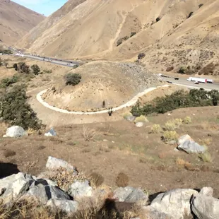
Big Bear
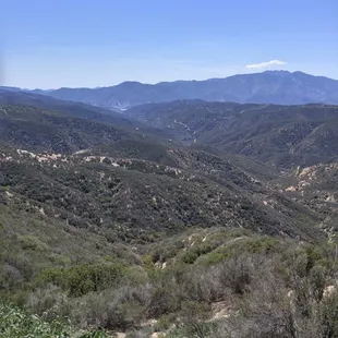
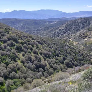
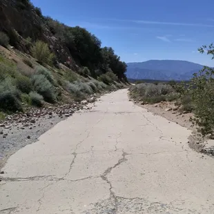
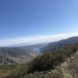
More scenery.
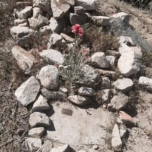
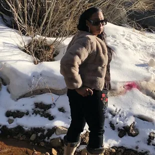
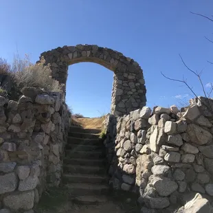
Ok, well I will just put this here. Its final resting place. Bless his soul. Taken in April 2015
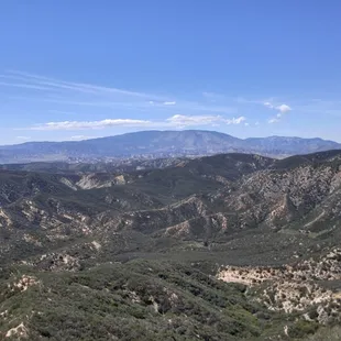
The view from the northern entrance. I was told by another guy that it's also blocked, but not for 5-10 miles in from Highway 138.
The view from the northern entrance. I was told by another guy that it's also blocked, but not for 5-10 miles in from Highway 138.
The southern end. Blocked a mile or two north of Templin Highway.
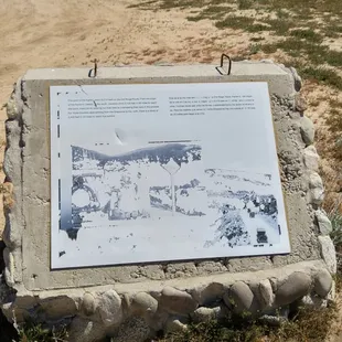
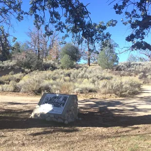
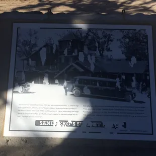
Informative sign along the road. Mostly worn away though. But still legible.
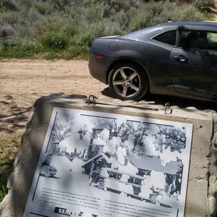
Informative sign along the road. Mostly worn away though. But still legible.
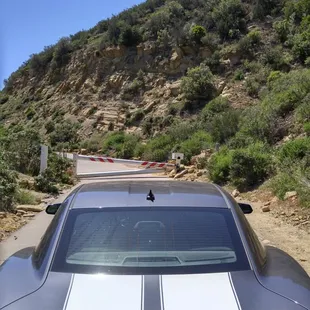
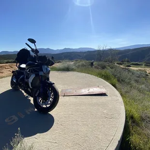
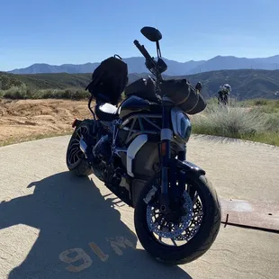
The road is unmaintained, and a bit rocky. Careful to you guys with Sedans and/or sports cars.
Paolo H.
Oct 22, 2015
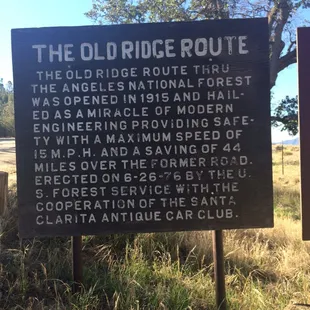
100 years ago, before the 5 fwy, people drove along the Ridge Route to get from LA to Bakersfield. It was was a 44 mile, two-lane, highway. It opened in 1915 and was in use until 1968 after it was replaced by the 5 fwy. Much of the road runs through the Angeles National Forest and passes by many historical landmarks. It's interesting to read about it's history and to view some of the old ruins. One of it's more distinctive sections is Deadman's Curve, located at the base of the grapevine. The Ridge Route is also listed in the National Register of Historic Places. There two access points that allow you to drive along southern sections of the road. From Los Angeles head north on I-5 freeway. Exit at Castaic and take Parker Rd to the Ridge Route. This route only lets you experience a small portion of the road. It was blocked off after storm damage in 2005.I recommend continuing along 5 fwy north and exiting at Hwy 138 heading toward Lancaster. You'll pass a reservoir on the left and you will eventually see a sign for "Old Ridge Route" located on the right. This route provides some nice views of the area and also allows you to see some of the locations of the historic hotels. Sections of the road can be a little rocky since it's no longer maintained.
Read More
Frank H.
May 17, 2020
In this time of coronavirus isolating, this is a nice getaway. We found an entrance off of 138 just east of Quail Lake and headed south. It is very remote and in places the one hundred year old road bed is covered with dirt and rocks from slides. Most of the people we saw were on touring type motorcycles, SUVs and trucks hauling bicycles, and a few off road enthusiasts. It is beautiful country to travel thru, everyone we saw was driving very carefully and respectfully. There was a huge locked gate after a while and we turned around and went back to 138. Then we went back south on I 5 to Templin highway east. After a few miles we hooked back onto the Ridge Route and followed it all the way into Castaic. The first section off of 138 was much more scenic and beautiful.We saw a few cars, but it is better to be in a vehicle with good ground clearance. In the bad spots there are very many sharp rocks, there is a need for good tires too.We had a great afternoon and were able to get away during this time, while still practicing the social distancing. Our trip was taken in a two wheel drive half ton Silverado, we had no trouble. I can see that if there was bad weather, this would not be a good road to be exploring.
Read More
Scott B.
Apr 7, 2016
Looking for a local adventure, I stumbled across this one while looking at the back of my Huell Howser roadmap. It said that this road was crafted 100 years ago, as the original road from Los Angeles to Bakersfield. I also discovered online directions to actually find and drive onto the old road. Cool! That sounds like an adventure! So I hopped in the car and drove towards the southern side of the road, up in Castaic. I followed the directions, passed where I went to movie school, and continued along Old Ridge Road. Eventually, I hit a block. Iron poles were formed into an impassable barrier. I even attempted to open it up, but several padlocks further locked the gate. Bummer. It's been fun so far, let's not let a little closed gate stop this trip! I climbed back into the car, and hopped on the 5 freeway. Ironically, the road that would eventually replace the little old road I was actually trying to get onto. I drove north for about thirty minutes to reach the northern end of the old road. I passed an old information marker, which was heavily faded and sun-bleached, but mostly still legible. It spoke of an old hotel that was once here. Grand and majestic a century ago, but reduced to nothing but it's foundation now. I drove on another few beautiful and scenic miles of unmaintained and slowly deteriorating highway, but eventually hit a stretch where fancy Italian racing tires were simply not meant to go. I parked the car, and got out for a stroll. There was another guy there in an SUV, and he said that the old road only went another mile or two before being also blocked by a great iron gate. I thanked him for the information and decided to walk another mile and a half or so before turning back. Again, majestically scenic and beautiful vistas of nature. This bit of the road was also heavily worn, with rocks from the hillsides that had spilled down onto it, creating caltrops that would have certainly damaged Baby's tires. Not too far from where I had parked, I also saw a second information marker in much the same condition as the first. This one spoke of the great climb up and over the mountain that would often stop many of the older cars in their tracks. It's certainly a neat bit of history. A road that's 100 years old is a rarity and a charm to visit. Just to sit and wonder what vehicles have travelled on it's old and worn concrete. History is great to see. There's history all around us if you take a moment to look. I'm certainly glad I did. Thanks Huell for putting it on your map.For More Information: https://www.youtube.com/watch?v=UXtw1bMxMWoFor More Information: https://en.wikipedia.org/wiki/Ridge_Route
Read More