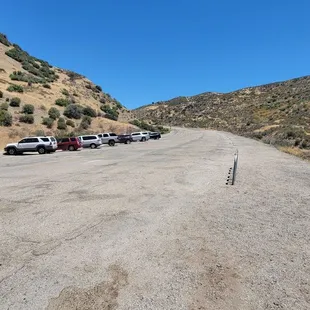
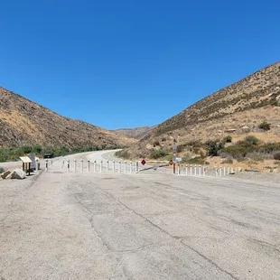
Parking.
Mushrooms growing in the middle of the trail (somebody poked them with their trekking pole)

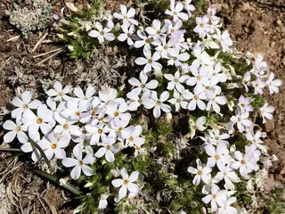
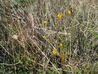
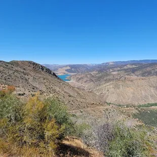
I've only hiked here in the Spring time and always wondered if the orange in the distance are poppy fields
Park and walk up the paved road for 1.3 miles.
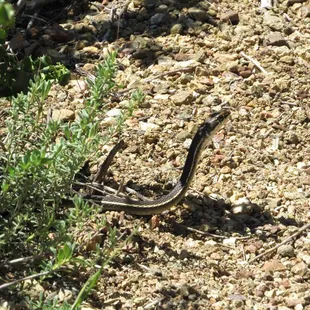
Striped Racer (Whipsnake) on trail. It's non venomous.
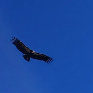
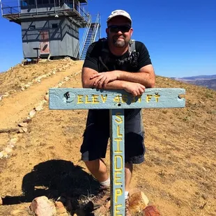
California Condor
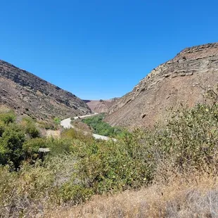
Continue up this dirt road for 3.6 miles.
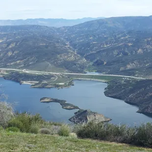
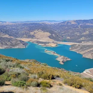
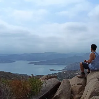
view at the top overlooking Castaic Lake
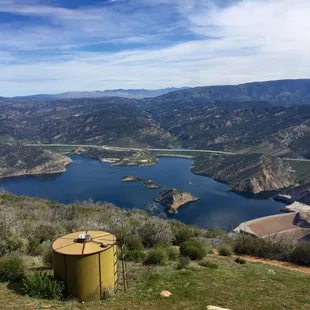
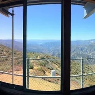
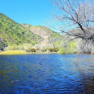
Overlooking Pyramid Lake and the 5 fwy from the lookout
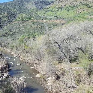
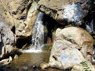
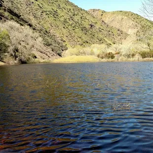
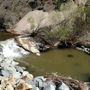
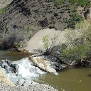
It's awesome to hear and see so much water.
Ed T.
Jul 11, 2022
This review is for the Slide Mountain Trail which was ~10.8 miles and took ~5 hours to complete. Brutal hike if you go during the summer since there aren't that much shade.There was ~1.75 miles of flat paved road before you hit the actual trail. Then it becomes straight incline all the way to the Slide Mountain Lookout! Trail becomes narrow at certain areas so watch your steps. The most rewarding view was the Pyramid Lake from the top.Short video of the hike: https://www.youtube.com/watch?v=pVvhZDb5LZM&t
Read More
Aileen R.
Sep 27, 2021
My 500th review goes to the strenuous Slide Mountain Fire Lookout Tower. This hike is difficult. Built in 1969. It is now a National Historic Lookout Register. The vistas up are are spectacular. 360 views which include: Pyramid Lake, Angeles National Forest and Los Padres National Forest. You can see Interstate 5 from up there. Our trek round-trip totaled 11.1 miles. You will have to hike on a paved road for the first 1 -1.5 miles and then you will get to the fire road to start your elevation gain. I definitely categorize this hike as strenuous/difficult. There is no shade on the trail. Bring plenty of water and snacks/meal. Also be prepared for any weather. All trails app is very helpful. Worth it!
Read More
Lucky S.
Mar 13, 2017
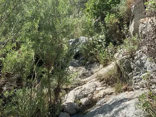
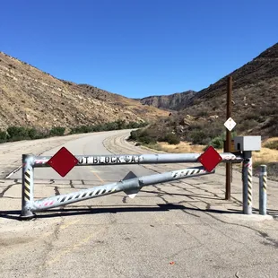
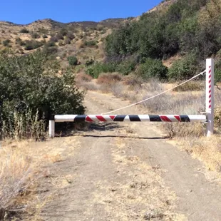
First off, the location on Yelp is wrong so if you use navigation from here, you will be going the wrong direction. Going north on the 5, exit Templin and turn left. You will then come to the old freeway (Golden State Highway Rd.) and go right. This will dead end at a locked gate/barrier and parking spaces in a few miles.An adventure pass is required so be sure to have one. :)You will walk along a paved (old freeway) road for about a mile and a half before seeing a locked gate/barrier (pictured) on your left, after crossing a bridge. This is the beginning of the dirt trail (no sign of humans and fairly overgrown vegetation so I don't think it's in high use) up to the lookout.Just after the rains, this walk on the old freeway was surprisingly pleasant. The sights and sounds of the water in the creek kept it far from boring. About halfway to the trail, if you look off to the left, you will see the lookout in the distance (far in the distance).Because of the time change, we got a much later start than we should have on this hike and it was an extremely hot day. THERE IS VERY LITTLE SHADE (LIKE ALMOST NONE)...both on the walk to the trail head and on the hike itself so take the sun into account and WEAR A HAT if you are thinking about this location.Once on the trail, we made it up the very steady ascent about a mile before deciding it was just too hot for the dog (yup, we could have made it no problem...it was all the dog's fault). Because of the incline, this hike is a good workout so BRING A LOT OF WATER.It wasn't just the heat though, the hike trail was biting bug ridden and super annoying so be sure to WEAR BUG SPRAY. I'm committed to making it to the top at some point, so I will be back, but it will be on a much cooler day!
Read More
Dean P.
Mar 17, 2017
Bring water and bug spray this is where those black mamba nats live. Seriously, these nats bite and it swells and itches for days.It's great to see the rushing water on the way to the trail after all our rain.Great place for a hike and getting out and exploring.
Read More
Melanie D.
May 1, 2016
This hike is just short of 11 miles round trip with 2,775' elevation gain/loss.The trail starts off on a flat asphalt road for the first, boring 1.7 miles. Then the trail turns left and up and is a wide, smooth, dirt fire road with minimal rock under foot. As the trail progresses, it becomes single file. Most of the hike has a fairly steady ascent, but it does have some areas where it is a bit steep. Overall, it is a good workout but not that difficult. There is no real shade, so I would avoid this hike during the height of the summer.At the summit, there will be a lookout tower and a very picturesque view of Pyramid Lake, rolling hills and mountains. It is a beautiful 360 degree view. parking - free parking just off the road where it dead endstip- adventure pass required
Read More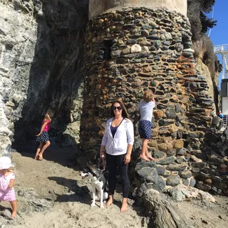
Amy B.
Jul 13, 2015
If your planning on conquering this 10.8 mile hike there are a few things you that you should know to make the most out of your adventure.First thing first: from LA if your taking the 5 North, get off on Templin Hwy and make a left. Once you get to the T make a right and drive approximately 4miles until you reach a gate that won't let you go any further. Park here and make sure to display your adventure pass. Second thing: bring a bike. The first 1.7miles is on a smooth paved road, riding your bike helps get you to the trail head faster. Then you leave your bike at the trailhead (the paved road is private so you don't have to worry about anybody stealing your bike) and when you return from the lookout you will be grateful to hop on your bike and just coast down hill the remaining 1.7miles back to your car.**the trailhead is exactly 1.7miles from the private gate (no worries you are allowed back there, just not your car ) and is marked by another white gate on the left hand side. Also bring lots of water, snacks and bear spray. It's a long hike, all up hill and the water will keep you hydrated, the snacks will keep you from becoming hangry and the bear spray will give you the illusion of safety... There were a few moments that we heard rustling in the bushes and in the vast wilderness it can be a tad intimidating. Next thing: just keep going! The hike is approximately 5.4 miles up to the lookout and you can't see the tower until 5.2miles... Let me tell you, when the entire hike is uphill like this 5.2 miles seems a lot longer. So just keep walking and when you feel like you can't go anymore or you feel like you made a mistake ( which is impossible because there is only one trail) just keep going and you will eventually reach that "awha moment!" Make sure to sign in at the registry and say hello to the volunteer who works the fire lookout. The day we went Jim was working there and he was nice enough to give us a tour and explain some of the history around the area. It's really interesting, and this is the perfect spot to eat your snack.All in all this was another great hike!
Read More
Brian U.
Mar 12, 2019
One of the better hikes in Los Angeles County with a pleasant trail and continuous views.Okay, the beginning isn't great. The hike starts with a walk on an abandoned highway - the road that was replaced by the current I-5. Park at the end of Templin Hwy next to Frenchman's Flat Campground. Walk 1.7 miles up the mostly flat highway used as the road to Project Pegasus in "Captain Marvel" and turn left on forest road FS18W04 to begin the real part of the hike to the Slide Mountain Fire Lookout Tower. The trail starts as an unpaved service road but then narrows to a regular hiking trail with soft dirt that is well-maintained and evenly graded.Along with views of exposed sedimentary layers on the neighboring mountains, Lake Piru was visible to the south and Pyramid Lake with dam and Vista del Lago Visitor Center (see https://www.yelp.com/biz/vista-del-lago-visitors-center-gorman-2) to the northeast. I-5 is also seen but very little noise came from the freeway. The summit was windy and the temperature dropped 9 degrees due to the 2600' elevation change. The sign-in ledger at the summit also had many comments about the wind. The beginning and end of hike both have portable toilets but no water. The entire hike is 10.8 miles roundtrip.
Read More
Paolo H.
Jul 7, 2015
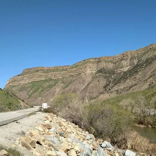
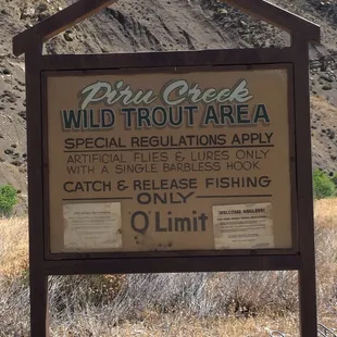
This is a fun 10-mile (there and back) hike that takes you to the top of Slide Mountain where there's an historic fire lookout tower that was built in 1969. The tower is a two-story metal structure with the cab on top. Once you reach the top of Slide Mountain you'll also get to appreciate a gorgeous 360 degree view of Pyramid Lake, Pyramid Dam and sections of the Angeles National Forest. To get to the trailhead take the I-5 North, past Castaic, to Templin Highway. Exit the freeway, turn left, and continue under the freeway overpass and then take a right on Golden State Highway Rd. Head north for about 4 miles and then road will dead end at Frenchman's Flat. There you will see a parking lot and a locked gate. Park in one of the designated spots (you will need an Adventure Pass). Walk past the locked gate, up the paved road, for 1.7 miles until you reach a gated dirt road off to the left. From there you will need to walk another 3.65 miles to reach the Lookout. The paved road that you initially walk along follows Piru Creek. Piru Creek offers catch-and-release wild trout fishing. I've read a few fishing blogs that mention that the trout population is extremely low since the creek doesn't get restocked. The paved road dead ends at Pyramid Dam. Off to the right on your way to the dirt road you will see an intriguing sealed entrance at the base of the mountain. It's part of the Angeles Tunnel, a 7.2 mile-long and 30-foot diameter, water tunnel. The tunnel supplies water to the adjacent Castaic Power Plant. I've read that when demand for electricity is high, usually during the afternoon, water is withdrawn from Pyramid Lake and released into Castaic Lake. At night, when demand is low, water is pumped back into Pyramid Lake. You won't actually see the Lookout until the very last section of the hike. The volunteer that was manning the tower the day I visited said that it was common for people to turn back right before they reach the end. You'll know that you're nearing the end when you come across a small cave and a row of red reflectors. I found a really cool video that someone posted that shows drone footage of the Lookout. It's definitely worth checking out. https://www.youtube.com/watch?v=Mw5qyjeQw98
Read More