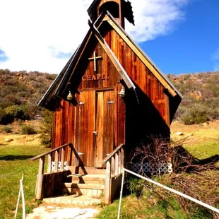
Remnants of days gone by. Los Padres National Forest-Reyes Creek
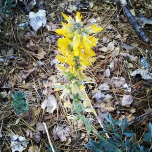
Yellow lupine
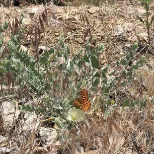
Beautiful butterflies
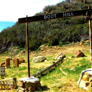
Remnants of days gone by. Los Padres National Forest-Reyes Creek
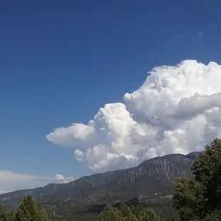
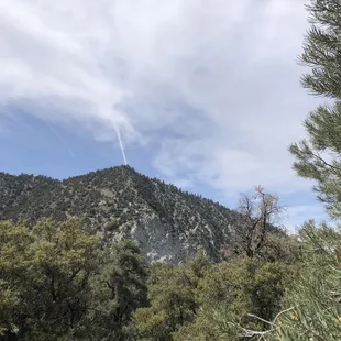
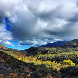
Thunderhead over Mt Pinos
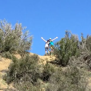
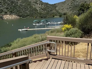
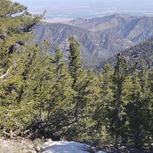
SisTa and I made it to the top of Reyes Creek Los Padres National Forest-Reyes Creek
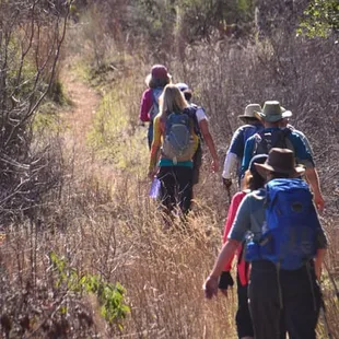
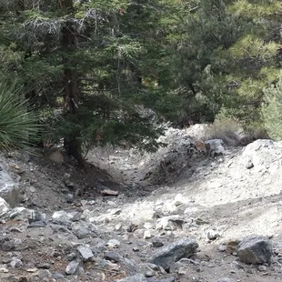
Mostly exposed trail Los Padres National Forest-Reyes Creek
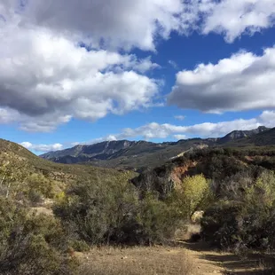
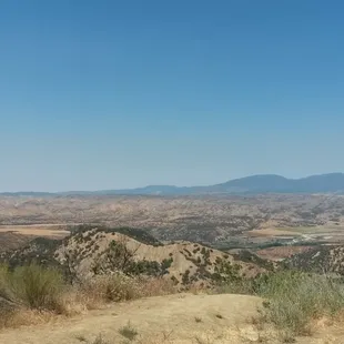
Great views
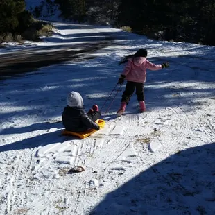
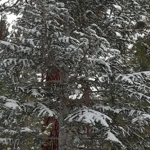
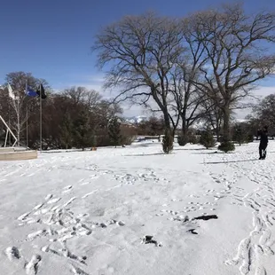
Snow!
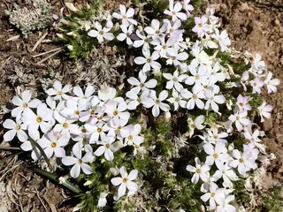
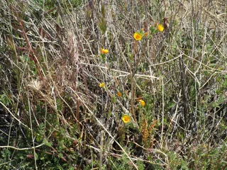
Wild flowers
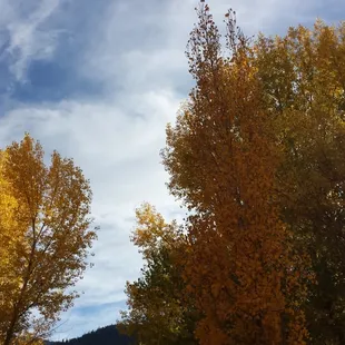
Autumn!
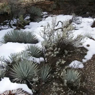
Snow with yucca
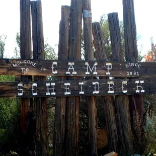
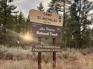
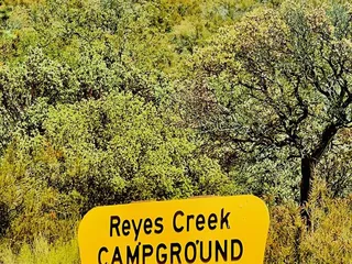
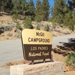
Entrance to the camp Los Padres National Forest-Reyes Creek
Sespe River Trail
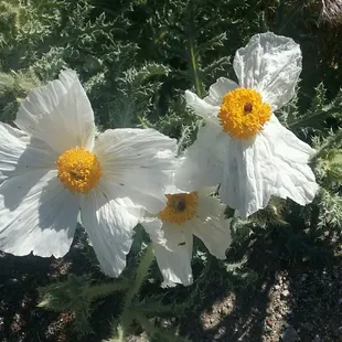
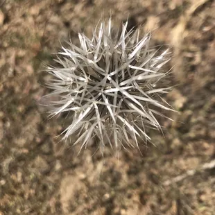
Prickly poppies


Aileen R.
Dec 28, 2020
Overlooked forest since Angeles Forest is nearby. We love Los Padres National Forest. The little town of Frazier Park is the last town before going up to Los Padres. We love the quietness and solitude you find here. The trees and winds make this beautiful sound. I honestly think this place is sacred. We have camped at McGill Campground and have hiked up to Mt. Pinos. Only about an hour drive from Los Angeles/Santa Clarita. The forest does get snow fall and I think we just had the first big dump of snowfall last night.
Read More
Mei L.
Apr 30, 2022
It's a forest. Lots of trees. Lots of rocks. Please be safe with your fire. It's very flammable.
Read More
Doris W.
Nov 5, 2015
I never realized I've experience Los Padres National Forest a few times in my life until I looked at a map this weekend lol. I went to a tennis academy in Ojai when I was in high school and it bordered the forest, 2-3 years ago I hiked to Tar Creek near Fillmore and that's in the Los Padres National Forest, and this past week I went backpacking to Willett Hot Springs which is also in this national forest!Tar Creek is now closed to the public due to condor nesting, but from what I remember when I hiked the area, it was pretty awesome with some good cliff jumping spots. Sespe River Trail to Willett Hot Springs was awesome too! This area has definitely been affected by the California drought though. There's like no water in the Sespe Creek except for some spots here and there that are spring fed water coming from the ground. It's beautiful out here though! Any lover of nature would appreciate this area. Not too far from the big cities, yet when you're here you feel disconnected from the world.
Read More
Janna L.
Jun 26, 2016
Beautiful, desolate, mountainous, a hiker's dream, lots of wildflowers is how I would describe it! We were just driving through to take the scenic route to Ojai and am so glad we did.Be sure to have a full tank of gas, snacks and water, just in case.Beware of many sharp curves, high elevation with steep drop offs (no guard rails in some areas) and many cyclists and motorcycle riders sharing the road.It was neat to see trees growing right out of the rocks in some mountain areas.I am sure landslides happen here all the time but the road was well maintained and smooth on this date, clear of rocks/boulders.Lots of places to park off the road at certain points for photo ops.We were on the lookout for animals but it was a hot day - we only counted several birds and one cute chipmunk!
Read More
Isobel L.
Aug 24, 2014
Angelenos may drive through Los Padres National Forest and wonder why on earth the dry scrub brush by the road is considered a "forest."Little do they know that beyond the highway lies a gigantic national forest (almost 3,000 square miles) that includes:1) Mt. Pinos, an 8,847-foot mountain famous for gorgeous evergreen trees, snow and star-gazing2) Jacinto Reyes Scenic Byway, a beautiful drive on Highway 33 and an official State of California Scenic Highway3) Plentiful Douglas fir and Ponderosa pines at Pine Mountain Ridge4) Some of the best hiking in the state of California5) Lots of other things to do (rock-climbing, photography, camping, even target practice....please shoot responsibly)So, Angelenos, next time you're wondering what to do, check out their website at http://www.fs.usda.gov/main/lpnf/home and make some plans. You will not regret it.
Read More
Stephanie P.
Oct 26, 2015
HIKIN TO A BURGER JOINT IN THE MIDDLE OF NOWHERE!BACKGROUND:Sespe Wilderness provides ample evidence of past violent geological upthrusts. The landscape is bleak and jagged, and if you climb high enough, you'll find pine trees growing at odd angles on boulder-swept hillsides. Sespe Creek, the last remaining undammed river in Southern California, runs for 31.5 Wild and Scenic miles (most of it in the Wilderness), and 10.5 miles of Upper Sespe Creek are under consideration for designation. Sandstone cliffs rise as much as 500 feet above the water in places, and fabulous sandstoneformations stand in portions of the area. You may see petroglyphs and other evidence of ancient Indians. You might also spot black bears, deer, mountain lions, bobcats, coyotes, rattlesnakes, red-tailed hawks, and golden eagles. STATS:Approx 10-12 miles RT Elevation Gain: 2400-2700 ft.Rating: Intermediate-strenuousTrail: Single track, creek Trek: Lollypop WATCH OUT FOR:Black bearsDeerMountain lionsBobcatsCoyotesRattlesnakesESSENTIALS:At least 2 liters of water Know your limitsComfy hiking shoes with good lugsLayered ClothingHigh protein food/snacksElectrolytesCameraHat (optional)SunscreenTrek poles (optional)OUR ROUTE:Our route started from the West at the end of Camp Scheideck Rd., where the trail ascended for 2.5 miles. We trekked through oak and chaparral until we reached saddle. From there it was .5 miles descent towards Reyes Creek and Upper Reyes Reyes Camp.After a short break, in a shaded meadow, we continued from the meadow southeast, ascending a ridge for 1.5 miles, which involved a rope, crumbing rock and semi-sheer cliffs. A little nerve racking for those afraid of heights. Once at the top we descended towards Beartrap Creek and Beartrap camp where we lunched in yet another meadow and campsite. This campsite has 5 stoves amidst cedars, alders and conifers with year-round water. Meandering through the meadow with some creek crossings and bush whacking, we eventually found a civilized trail which converged with our initial trail that lead us back to the trailhead. DISCLAIMER: Hiking is not something that can be taken lightly. It can be life-threatening as you see and hear on the news, people die or get lost all time. Please, if you are going to hike, never go alone and prepare for the worst, hope for the best. Remember when going for a hike, no matter how short you think it may be, always be prepared. Carry at least two liters of water for every five miles (more if the weather is warm), protein bar, nuts, and electrolytes. Wear sturdy lug sole shoes and protective clothing. Some areas the weather can change quicker than a fireman can put on his gear. It is also very important, always always always let a family member or friend know where you are going and when you expect to be back. Lastly, have fun when you hike it up.
Read More
Tiffany L.
Nov 30, 2017
Driving through Los Padres National Forest (especially when you're on Nacimiento-Fergusson Road heading west toward the central coast of Big Sur) is decidedly not for the faint of heart! Those brave enough to take this trek will encounter numerous hairpin curves along a road that's so twisty it's safe to say that it meets itself coming around corners ;-)Tip: While driving through, you'll pass numerous drops-offs higher than a thousand feet with not a guard rail in sight, so exercise extreme caution! It would also be a good idea to drive here only in the daytime.Bearing in mind all the above cautions, Los Padres is a hiker's dream! The terrain can be steep and rugged, but many of the trails boast views that should not be missed. If you're a seasoned hiker, you will not regret an excursion here.
Read More
Tricia S.
Feb 10, 2021
This is one of the most beautiful breathe taking area's to live in .. fresh air with gorgeous mountains sunny or snow all 4 seasons up here and only 90 mins away from Los Angeles . Gods country
Read More
Tracy M.
Aug 16, 2020
A truly beautiful area. Came here to camp for the first time and will certainly be back.
Read More
Alan T.
Aug 11, 2011
I swear I constantly thought we were lost when we approached the uphill driving.Bachy told me this place was around 50 miles away from good ole Westminster...Checked the map the night before... 100-ish miles;damn.My trio and I geared up. 10 mile round trip, 75-85 degree weather, several semi-steep climbs, rocky descents and crossing of small streams;my boys brought their usual packload; knives, rope, clothes, medkit, food, water, extra socks, and Tim brought some hiking sticks.Lunch, water pack, and knives were all I needed ^_^90-something miles and an uphill drive later, we arrived w/ 2 other cars on a flattened area.My car was covered in a nice, thick, crusty layer of that fine, red dust that seemingly blanketed the mountain.We set off...11 of us...Dalton led the way;I watched the rear.1.5-2 miles passed before we reached a rather rocky descent.T'was slippery and easy to lose one's footing due the looseness of the small rocks;take your time.There was a fork soon after the downward climb. Not sure if it's still there, but some boyscout/hiker left an arrow pointing one way and branches in the shape of an "X" on the other path.Follow the arrow.Another mile or so and we reached the first jump;an algae-filled pool off water beneath a ledge.The people of Fillmore (nearby city) often come here to enjoy this unique land feature.I didn't feel like jumping.After an hour or so, we trek on to the next jump;this next little pool was 80 ft below the ledge and people have safely jumped into it.This jump was more dangerous not only because of the greater height, but because this jump had some ledges and rocks.Jumping too far in any direction, and well, your hiking trip is ruined.None of us could find an easy route back up had any of us jumped.No one jumped.We decided to have lunch before the hike back.Some skipped rocks in a small pool near by...I chose to toss rocks off the side to see how long it'd take to hit the water.You know how they say, "boys will boys;"well...eventually we saw a 150-200lb, semi-round boulder that we had to roll off the edge...Took 4 of us almost 10 minutes to move it 30 feet to the edge...Totally worth it.Soon as the rock rolled off the edge, we were rewarded with a couple seconds of silence was interrupted with a large gun-shot like cracking sound, immediately followed by numerous sounds of splashes.We were satisfied.Packed up, saw a couple water snakes, tried to catch them, failed, started the way back.We were told that there was a 40 feet jump after the 80 footer, but we didn't see the path;the 40 footer, they say, is the safest jump.Check the depth of each pool before jumping.Safety first.We returned to the 20 footer and spent another hour or so jumping, relaxing, and for me... sleeping underneath the shade of a rock.I still didn't feel like jumping.The hike back held more surprises than we had expected.Chad almost stepped on a 2 foot-long rattle snake.Lucky for us, it had just eaten and thus, did not rattle or bite.The shrubbery along the creek bed made it difficult to clearly see the return path.We split up to find the right way back.Good thing Tim brought walkies.That downhill, rocky climb that we met earlier had transformed into a more formidable, towering obstacle. We took several breaks to make sure the no one got too tired. The many quick stops/water breaks was well worth possibly preventing a fall.Reaching the top was no victory;the hike wasn't over.The land was now more solid and flat, but weariness crept upon us. We were no longer near the creek; no more cool, moist air to mitigate the sun's heat. Emily's feet began to drag. Bryan's boot came apart. This path felt longer than before.The cars were soon visible. As if a joke from some greater power, there lay two small boulders along the perfectly straight, leveled path that we had to hop over. Alarms deactivated.Trunks popped open.Gatorade like celebratory champagne.Smile and laughter returned.We made it.No tragedy like my hike at Eaton Canyon. No hiker died like my recent weekend in Yosemite.The weariness from the 2-3 hours of sleep the night before set in.I dozed off in the passenger seat of my Honda while everyone was still talking. I awoke to find all of us at the Chevron station at the bottom of the mountain. Tim didn't want to disturb me so he took it upon himself to drive.Thanks, Tim.Don't underestimate the wilderness. My group and I prepared for the hike and we were still caught off guard. Be sure to try and remember the path you take. Taking pictures via cellphone is a great help. Be careful when near animals. Watch your step when crossing the creek bed; dry algae can still be slippery. Drink water. Lots of it.Be safe.
Read More