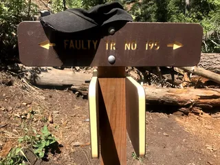
One of the two places where you will probably lose the trail. This is looking down the trail, but coming up stay left.

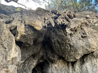
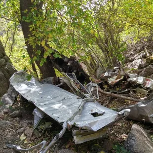
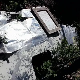
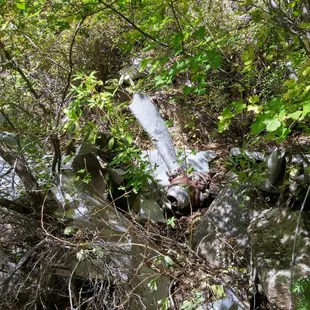
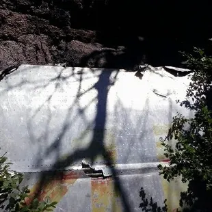
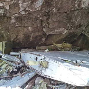
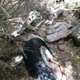
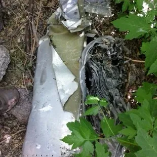
A small sample of the debris
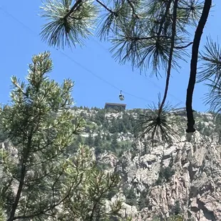
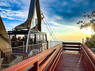
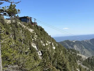
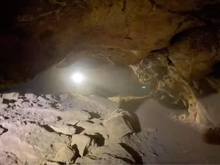
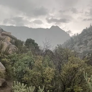
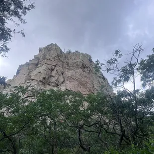
When the tram is directly overhead you are essentially at the crash site
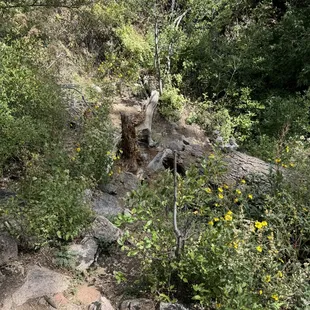
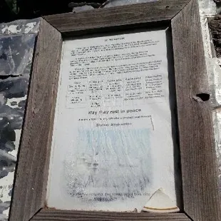
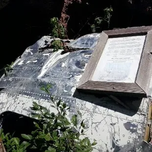
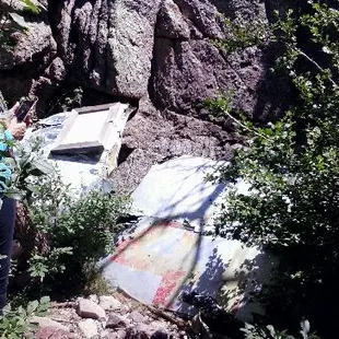
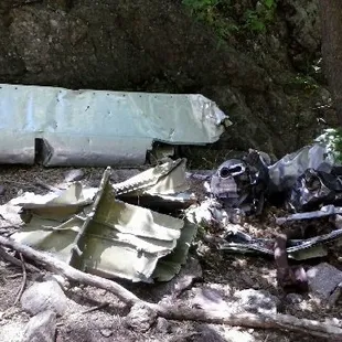
At the crash site
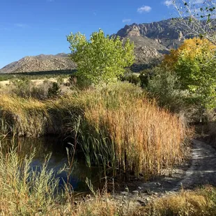
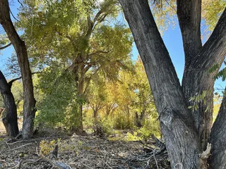
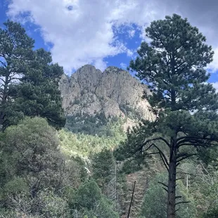
The view at the beginning of the hike from the Elena Gallegos picnic area.
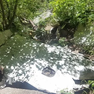
TWA wreckage
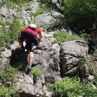
Trust me...don't lose the trail!

Misery.


Robert M.
Dec 26, 2024
Water, water, water! Bring at least 3 litters of water. You will not have any left over. It is a true kickass hike! The last time I did it I was scrambling up a steep rock face, and there was a gentleman waiting for me at the top of the rock face who encouraged me by saying, "you are almost at the crash site!" When I told him that I knew because I had been there before, he responded in amazement and asked, "why the heck did you come back?!" Yep, for many, it is that kind of hike! I believe it is rated at 4.8 out of 5 in difficulty, and by the time you finish the last half mile or so you will probably agree. Download a topographic trail (i.e. AllTrails) map on your phone, and you might need to bring an extra power source, because your phone may drain down searching for a cell signal while you lay down electronic breadcrumbs on the digital map. However, there are two places where it is almost guaranteed that you will miss a turn, and add some "bonus" miles. You definitely don't need "bonus " miles on this hike. You pass through at least 2-3 biomes as you ascend and descend. It's an interesting hike, but be prepared to give yourself a pep talk or two along the way Up. Also, expect your legs to be shaky by the bottom. Decending is a lot of eccentric contractions, which only fire about half the muscle fibers as concentric contractions. You can fact check that yourself. This is a hike to build up to. Remember - the best rescue is a self rescue! Have fun, be smart, and be safe.
Read More
Michael H.
Jul 21, 2024
First off the address is not correct. The trail is Trail #230 Domingo Baco. This is a hard trail. We made it past the crash site but then lost the trail we made it to the top but I do not think we were on the trail at that point. A storm was brewing so we opted to turn around. We ended up with just under 6 miles one way and roughly 3k feet of elevation. The storm popped over the mountain quickly so we were glad we were on our way down when the bottom fell out and the hail started. I was shocked that so much of the plane was still there. It was a very eerie site to see especially for someone who flys often. Great trail, very physical but not impossible as I am 56 and made it. Beautiful trail with a lot of variety. The size of the trees up there shocked me. Oh yes and beware of the briars at the top. Didn't pay attention as I was struggling to climb up a decent rock face and at the top break over point I grabbed and they grab back. Again I think at this point I was off the trail.
Read More
Sky-Lynn N.
Sep 22, 2023
This was a beautiful hike. It is, however, extremely difficult! I am from New York. I have never done a hike this long or this rigorous. I severely over estimated my abilities here- as I've never done a hike over an hour that isn't elderly friendly. As a 25 year old woman who sometimes works out- this absolutely wrecked me. My friend and I looked at the level rating "difficult" and had a false sense of "how hard could this actually be?". The answer is very hard. We should've done our research but instead went in blind. I had an 8oz bottle of water and tried my best to ration. Half way up we got a little lost and probably added an unnecessary half mile to this whole thing. I had to have my friend remove cactus needles about 3x during our hike. While I felt like I could absolutely pass away for most of the way up, I have zero regrets. The plane wreckage was quite a sight. After making it back down I had a sense of accomplishment and absolute shock that I made it out alive. A day later and EXTREMELY sore but happy to have done it. Pro tip from a non pro: bring more water than you think you would need and maybe take a look at the altitude and distance BEFORE you start your hike. I would rate myself a beginner and certainly say I was begging for my life at some points. Other than that, great time!
Read More
Dustin L.
Mar 29, 2019
To preface this review, I am an avid hiker, camper, and rucking enthusiast. I've conquered a lot of peaks and long distance challenges in my day and while I'd never say any of them are easy, they never really broke me.This one almost did.First off, I live in Ohio so I enjoy a nice thick 600 ft. ASL atmosphere 90% of the time and I'd done some other trails in the ABQ area and while I got winded faster, I was still able to recover fairly quickly so I figured this would be no problem at all. I was SO wrong! The plan was for our group to hit the TWA memorial/crash site and continue on up to hit La Luz. I want to echo the first reviewer on the water warning...in fact, double what you think you'll need. You can always pour it out if it's too much, but you're screwed if it isn't! Protein is essential as well as quick carbs to give you a boost when you're feeling poopy-pants. One of my buddies had an electrolyte packet that might have actually saved my life, so take that for what it's worth too! I forget exactly what point, but there is a point on the trail where you have to switch over to another trail and it isn't very clearly marked...we had to over-land it and cross a stream, but eventually came upon it. The rest of the way up to the crash site is what you would expect. Take as many breaks as you see fit, and conserve energy when you can. The crash site is really cool and super humbling. Be respectful, as it is a memorial.After this, things get fuzzy. We proceeded up following a series of thin and windy footpaths/gametrails with white markings presumably left by other hikers who blazed them. We finally lost the trail at the bottom of a sheer cliff face and I had reached the point of no return. I was now almost completely out of water and taking tiny sips to conserve. There was only one direction to continue. Up. We worked our way along the bottom of the cliff until we found a 45°-60° ascent in a grass field and I was at a point where I had to stop literally every 20-30 ft and catch my breath and rest. I was out of water and heading into heat exhaustion rapidly. Just at the point where I was seriously kicking around the notion of calling for helicopter rescue, my buddy heard voices and started yelling asking if they were on the la luz...a confused and surprised reply (probably wondering who the hell would ever be down this incredibly steep mountain) came back and said yes. An eighth of a mile later I was laying down on a boulder resting, but the panic was over. We knew where we were. The rest was a weak pitiful stumble to the team for a ride back down to our ride.In conclusion, it was an amazing experience that would have definitely been better had we been more prepared and hadn't suffered some nearly catastrophic miss-steps! If you're lookin' for a good time and a great challenge, do it...but be prepared. It's not gonna be easy!
Read More
Erin S.
Oct 18, 2015
I hiked the TWA trail for the first time yesterday, and it was a killer! From the Elena Gallegos picnic area, it's about 5 miles round trip with 2,500 feet of elevation gain. The hike winds you through Domingo Baca Canyon in the Sandias and ends up right below The Tram line at the crash sight of TWA flight 260, which crashed on February 19, 1955. The wreckage is sad to see and is scattered throughout the area. You can also continue up the "trail" past the crash sight to converge with the La Luz trail to The Tram at Sandia Peak. We did not do that though, as I was (a) exhausted and (b) heard that it's easy to get lost on that path as it's really steep and overgrown. If you do make it up that high, you can ride The Tram down vs. hiking down the mountain.Tips: - Bring enough water! I had two bottles and could've used two more, especially during the climb. During the final mile, I kind of wanted to die. I could tell the air got thin and my muscles were screaming! I live in Albuquerque and feel like I'm pretty acclimated to the altitude, but this hike humbled me. I don't recommend it for people that are visiting from sea-level. - Sunglasses/hat/sunscreen. The lower half of the trail is in the open desert, and it was hot even in October. Once you get higher up, there is a lot of tree cover and shade, and it was plum chilly at the top. Plus you'll be drenched in sweat, so that makes it cold when you stop moving. Layers are key! - Comfortable hiking shoes. The trail goes over a lot of loose rocks, sand, and slick boulders so it's nice to have shoes with some traction. My feet and legs were so dead by the end but at least I didn't have any blisters. This is definitely not a hike to try out your new boots on - be sure to wear something you've already broken in! Hiking poles are a good idea as well.There were also a number of obstacles on the trail, from boulders to climb up/slide down and fallen trees. There were a couple of times that instincts kicked in and I was legit scared, but I'm afraid of heights...and falling off a mountain. My palms are kind of sweating just thinking about it. Point being, not for beginners or the faint of heart. There were a number of dogs on the path too, so feel free to bring your pup on a leash. The dogs did better than I did! All in all, you'll enjoy great views of the city and feel like a bad ass when you finish. Definitely worth seeing, just be prepared!
Read More